Dudenhofen night lights from space
Night Light of Dudenhofen (Rheinland-Pfalz) from space (Germany) Src. Average luminocity for 10x10km area is 27.385% and for 50x50km: 24.3147%.
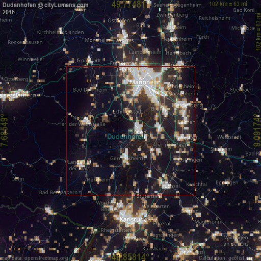
Analysis of Dudenhofen night lights 2016
Square area 10x10 km:
 6.82%
6.82%90-99
5.48%80-89
1.87%70-79
1.74%60-69
2.27%50-59
1.6%40-49
2.41%30-39
0.27%20-29
12.7%10-19
30.88%0-9
33.96%Square area 50x50 km:
4.5%90-99
4.9%80-89
2.07%70-79
1.94%60-69
2.55%50-59
2.33%40-49
2.98%30-39
3.4%20-29
7.89%10-19
20.69%0-9
46.74%Clear (daylight) street map image can be seen on geolist.org.
Map coordinates:
49° 46' 29.3" North, 7° 41' 7.8" East
49° 19' 7" North, 8° 23' 19" East
48° 51' 29.3" North, 9° 5' 30.3" East
Some cities around Dudenhofen sort by population:
• Speyer
3.1 km =1.9 mi,  85°
85°
• Schifferstadt
7.3 km =4.5 mi,  353°
353°
• Böhl-Iggelheim
9.2 km =5.7 mi,  318°
318°
• Oberhausen-Rheinhausen
7.8 km =4.8 mi,  129°
129°
• Neulußheim
9.7 km =6 mi,  103°
103°
• Lingenfeld
8.1 km =5 mi,  206°
206°
• Waldsee
9.3 km =5.8 mi,  23°
23°
• Altlußheim
8.2 km =5.1 mi, 103°
2934737 (p: 5,709)
Sources (retrieved 2019-11-25):
» Earth at Night: Flat Maps 2012, 2016