Celle night lights from space
Night Light of Celle (Lower Saxony) from space (Germany) Src. Average luminocity for 10x10km area is 30.9405% and for 50x50km: 4.3971%.
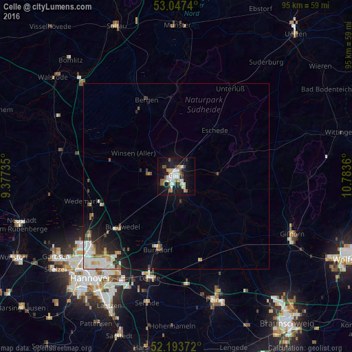
Analysis of Celle night lights 2016
Square area 10x10 km:
 7.41%
7.41%90-99
5.29%80-89
3.17%70-79
2.65%60-69
4.5%50-59
3.57%40-49
1.98%30-39
1.59%20-29
5.16%10-19
32.54%0-9
32.14%Square area 50x50 km:
1.01%90-99
0.86%80-89
0.36%70-79
0.42%60-69
0.47%50-59
0.51%40-49
0.33%30-39
0.5%20-29
0.95%10-19
2.79%0-9
91.79%Clear (daylight) street map image can be seen on geolist.org.
Map coordinates:
53° 2' 50.6" North, 9° 22' 38.5" East
52° 37' 21.5" North, 10° 4' 49.7" East
52° 11' 37.4" North, 10° 47' 1" East
Some cities around Celle sort by population:
• Burgdorf
20.2 km =12.6 mi,  194°
194°
• Winsen
13.1 km =8.1 mi,  300°
300°
• Hambühren
6.7 km =4.2 mi,  280°
280°
• Wietze
17 km =10.6 mi, 280°
• Uetze
19.4 km =12.1 mi,  154°
154°
• Wathlingen
10.6 km =6.6 mi, 153°
• Hänigsen
15.4 km =9.6 mi,  177°
177°
• Lachendorf
11.5 km =7.1 mi,  93°
93°
2940213 (p: 71,010)
Sources (retrieved 2019-11-25):
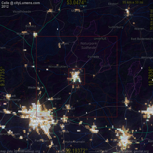
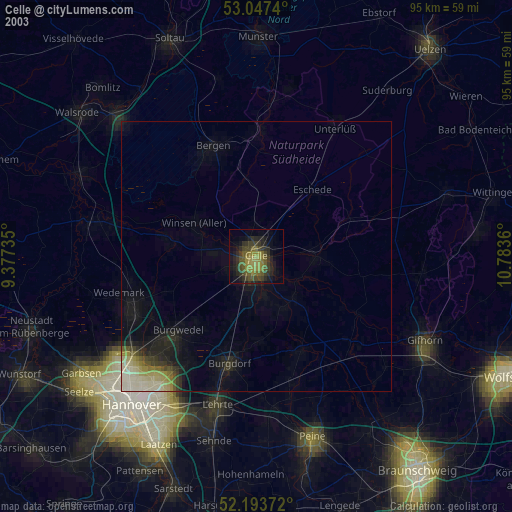
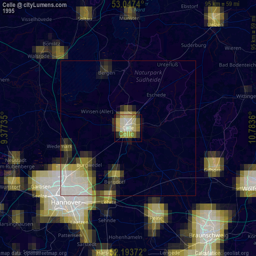
» NASA, Earths city lights 1995
» NASA city lights 2003
» Earth at Night: Flat Maps 2012, 2016