Kreuzberg night lights from space
Night Light of Kreuzberg (Berlin) from space (Germany) Src. Average luminocity for 10x10km area is 98.6005% and for 50x50km: 38.3502%.
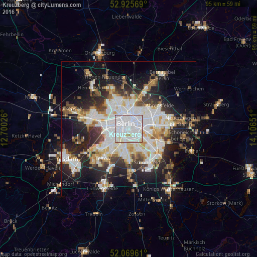
Analysis of Kreuzberg night lights 2016
Square area 10x10 km:
 70.63%
90-99
25.93%80-89
1.85%70-79
0.53%60-69
1.06%50-59
0%40-49
0%30-39
0%20-29
0%10-19
0%0-9
0%Square area 50x50 km:
10.98%90-99
9.49%80-89
3.68%70-79
3.09%60-69
3.28%50-59
3.52%40-49
4.18%30-39
4.46%20-29
8.7%10-19
16.48%0-9
32.14%Clear (daylight) street map image can be seen on geolist.org.
Map coordinates:
52° 55' 32.5" North, 12° 42' 0.9" East
52° 29' 59" North, 13° 24' 12.2" East
52° 4' 10.6" North, 14° 6' 23.4" East
Some cities around Kreuzberg sort by population:
• Berlin
2.8 km =1.7 mi,  10°
10°
• Neukölln
3.1 km =1.9 mi,  143°
143°
• Friedrichshain
3.9 km =2.4 mi,  63°
63°
• Mitte
2.3 km =1.4 mi,  2°
2°
• Tempelhof
3.7 km =2.3 mi,  183°
183°
• Berlin Treptow
2.9 km =1.8 mi,  103°
103°
• Tiergarten
3.1 km =1.9 mi,  307°
307°
• Alt-Treptow
3.9 km =2.4 mi,  108°
108°
2884161 (p: 147,532)
Sources (retrieved 2019-11-25):
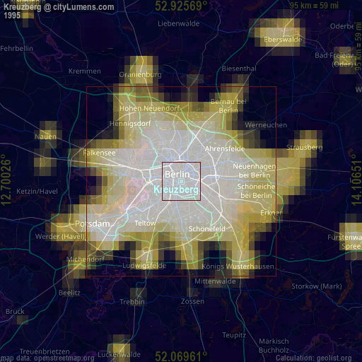
» NASA, Earths city lights 1995
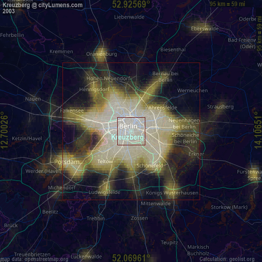
» NASA city lights 2003
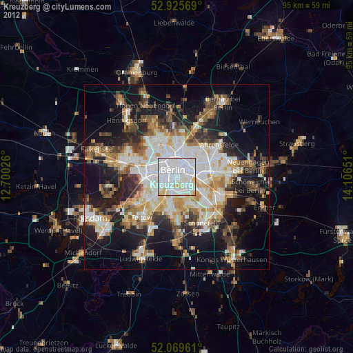
» Earth at Night: Flat Maps 2012, 2016