Bad Wurzach night lights from space
Night Light of Bad Wurzach (Baden-Württemberg) from space (Germany) Src. Average luminocity for 10x10km area is 1.5511% and for 50x50km: 2.8131%.
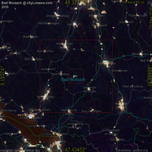
Analysis of Bad Wurzach night lights 2016
Square area 10x10 km:
 0%
0%90-99
0.57%80-89
0%70-79
0%60-69
0%50-59
0.57%40-49
0.57%30-39
0.57%20-29
0.57%10-19
0%0-9
97.16%Square area 50x50 km:
0.38%90-99
0.45%80-89
0.29%70-79
0.24%60-69
0.37%50-59
0.31%40-49
0.42%30-39
0.46%20-29
0.5%10-19
1.37%0-9
95.23%Clear (daylight) street map image can be seen on geolist.org.
Map coordinates:
48° 22' 37.8" North, 9° 11' 37.5" East
47° 54' 28.8" North, 9° 53' 48.7" East
47° 26' 4.3" North, 10° 35' 60" East
Some cities around Bad Wurzach sort by population:
• Biberach an der Riß
22.1 km =13.7 mi,  339°
339°
• Weingarten
22.1 km =13.7 mi,  240°
240°
• Leutkirch
12.9 km =8 mi,  134°
134°
• Aulendorf
19.9 km =12.4 mi,  283°
283°
• Ochsenhausen
18.5 km =11.5 mi,  12°
12°
• Kißlegg
13.3 km =8.3 mi,  184°
184°
• Bad Schussenried
20.8 km =12.9 mi,  301°
301°
• Baienfurt
20.3 km =12.6 mi, 244°
2953312 (p: 14,323)
Sources (retrieved 2019-11-25):
» Earth at Night: Flat Maps 2012, 2016