Bad Oeynhausen night lights from space
Night Light of Bad Oeynhausen (North Rhine-Westphalia) from space (Germany) Src. Average luminocity for 10x10km area is 11.6733% and for 50x50km: 5.7851%.
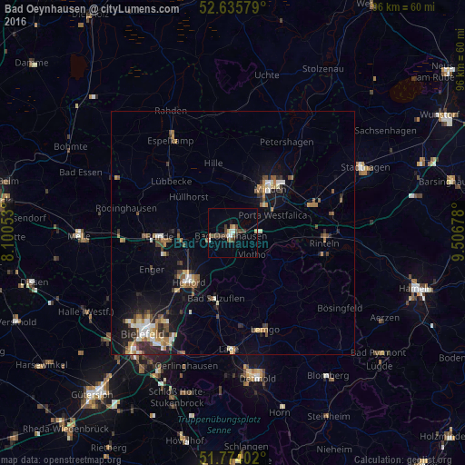
Analysis of Bad Oeynhausen night lights 2016
Square area 10x10 km:
 1.19%
1.19%90-99
1.46%80-89
1.59%70-79
0%60-69
0.53%50-59
3.04%40-49
3.97%30-39
2.51%20-29
0.53%10-19
0.53%0-9
84.66%Square area 50x50 km:
0.57%90-99
0.83%80-89
0.54%70-79
0.64%60-69
0.81%50-59
0.95%40-49
1.08%30-39
0.73%20-29
1.33%10-19
3.3%0-9
89.2%Clear (daylight) street map image can be seen on geolist.org.
Map coordinates:
52° 38' 8.8" North, 8° 6' 1.9" East
52° 12' 25.2" North, 8° 48' 13.1" East
51° 46' 26.5" North, 9° 30' 24.4" East
Some cities around Bad Oeynhausen sort by population:
• Minden
11.9 km =7.4 mi,  39°
39°
• Löhne
7.9 km =4.9 mi,  254°
254°
• Porta Westfalica
8.1 km =5 mi,  71°
71°
• Hiddenhausen
13.5 km =8.4 mi, 250°
• Vlotho
6 km =3.7 mi,  140°
140°
• Kirchlengern
11.6 km =7.2 mi,  266°
266°
• Hüllhorst
12.6 km =7.8 mi,  312°
312°
• Obernbeck
6.8 km =4.2 mi, 265°
2953386 (p: 49,513)
Sources (retrieved 2019-11-25):
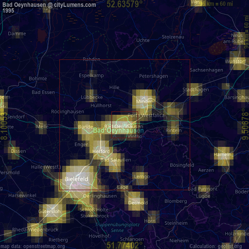
» NASA, Earths city lights 1995
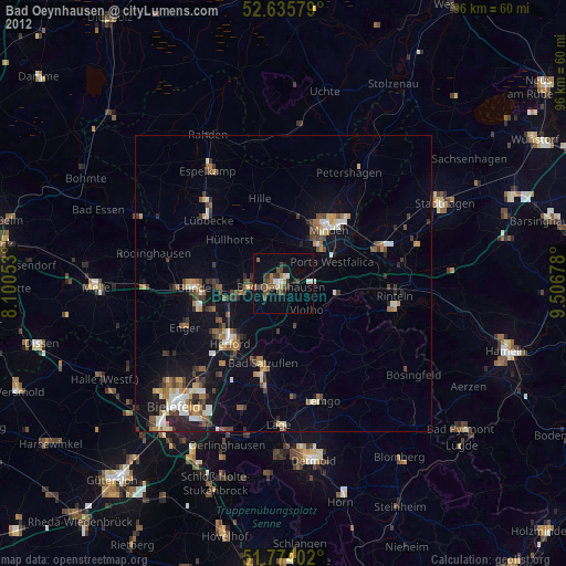
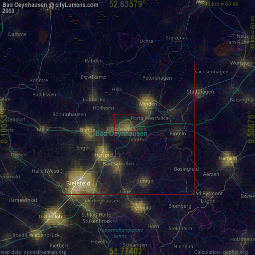
» NASA city lights 2003
» Earth at Night: Flat Maps 2012, 2016