Yingkou night lights from space
Night Light of Yingkou (Liaoning) from space (China) Src. Average luminocity for 10x10km area is 74.3425% and for 50x50km: 15.2677%.
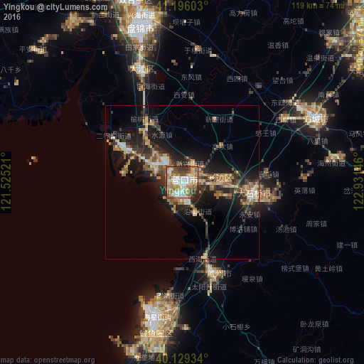
Analysis of Yingkou night lights 2016
Square area 10x10 km:
 16.4%
16.4%90-99
18.67%80-89
10.39%70-79
11.85%60-69
12.99%50-59
12.99%40-49
7.63%30-39
6.33%20-29
2.76%10-19
0%0-9
0%Square area 50x50 km:
1.37%90-99
1.59%80-89
2.07%70-79
2.24%60-69
2.83%50-59
2.62%40-49
1.75%30-39
3.86%20-29
4.86%10-19
10.96%0-9
65.85%Clear (daylight) street map image can be seen on geolist.org.
Map coordinates:
41° 11' 45.7" North, 121° 31' 30.8" East
40° 39' 53.4" North, 122° 13' 42" East
40° 7' 45.6" North, 122° 55' 53.3" East
Some cities around Yingkou sort by population:
• Anshan
81.9 km =50.9 mi,  51°
51°
• Panshan
60.1 km =37.3 mi,  345°
345°
• Haicheng
48.4 km =30.1 mi,  64°
64°
• Jiupu
75.4 km =46.9 mi, 53°
• Dashiqiao
23.3 km =14.5 mi,  97°
97°
• Xiuyan
97.7 km =60.7 mi,  115°
115°
• Nantai
56.4 km =35 mi, 59°
• Linghai
91.3 km =56.7 mi,  307°
307°
2033370 (p: 591,159)
Sources (retrieved 2019-11-25):
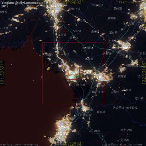
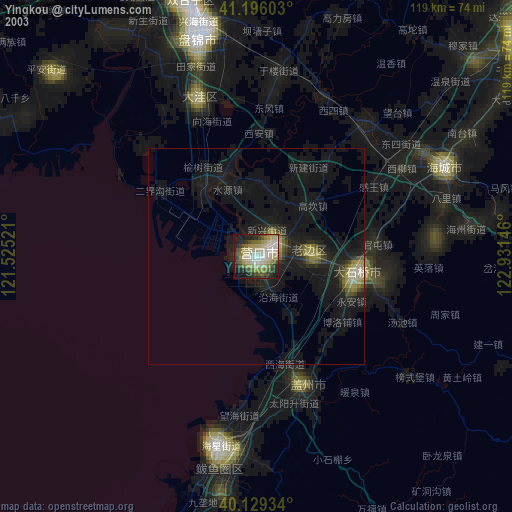
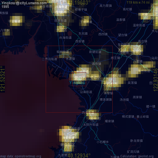
» NASA, Earths city lights 1995
» NASA city lights 2003
» Earth at Night: Flat Maps 2012, 2016