Nantai night lights from space
Night Light of Nantai (Liaoning) from space (China) Src. Average luminocity for 10x10km area is 12.551% and for 50x50km: 15.2421%.
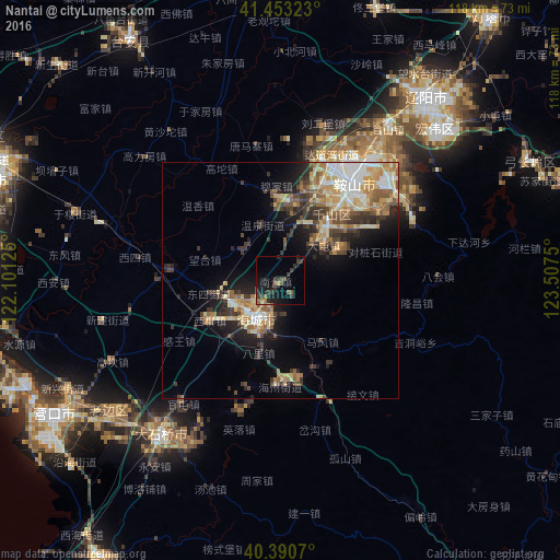
Analysis of Nantai night lights 2016
Square area 10x10 km:
 0%
0%90-99
0%80-89
0.51%70-79
0.85%60-69
1.7%50-59
3.23%40-49
2.55%30-39
6.46%20-29
5.1%10-19
15.31%0-9
64.29%Square area 50x50 km:
1.71%90-99
1.95%80-89
2.97%70-79
2.3%60-69
2.3%50-59
2.45%40-49
1.86%30-39
3.45%20-29
3.14%10-19
6.61%0-9
71.26%Clear (daylight) street map image can be seen on geolist.org.
Map coordinates:
41° 27' 11.6" North, 122° 6' 4.5" East
40° 55' 26.8" North, 122° 48' 15.7" East
40° 23' 26.5" North, 123° 30' 27" East
Some cities around Nantai sort by population:
• Anshan
27.1 km =16.8 mi,  35°
35°
• Liaoyang
49.5 km =30.8 mi, 38°
• Yingkou
56.4 km =35 mi,  239°
239°
• Haicheng
9.4 km =5.8 mi,  210°
210°
• Jiupu
20 km =12.4 mi, 37°
• Dashiqiao
40.8 km =25.4 mi,  218°
218°
• Gongchangling
58.2 km =36.2 mi,  68°
68°
• Liaozhong
65.1 km =40.5 mi,  354°
354°
2035635 (p: 56,478)
Sources (retrieved 2019-11-25):
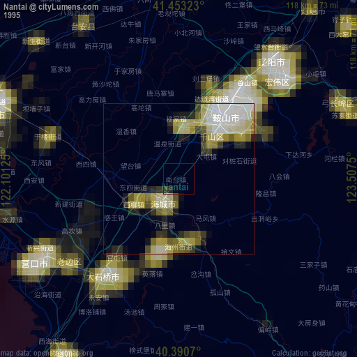
» NASA, Earths city lights 1995
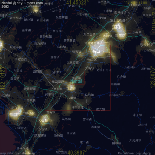
» NASA city lights 2003
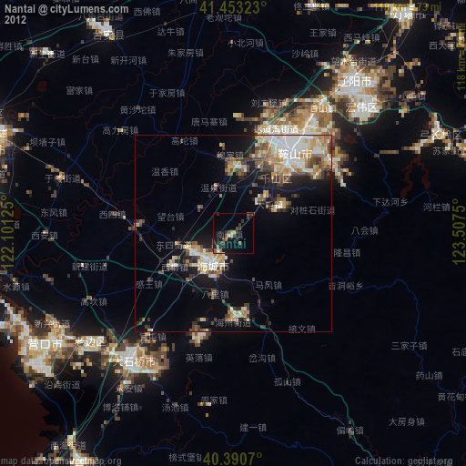
» Earth at Night: Flat Maps 2012, 2016