Xiditou night lights from space
Night Light of Xiditou (Tianjin) from space (China) Src. Average luminocity for 10x10km area is 55.1156% and for 50x50km: 51.3148%.
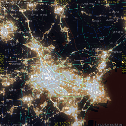
Analysis of Xiditou night lights 2016
Square area 10x10 km:
 0.34%
0.34%90-99
1.87%80-89
17.18%70-79
9.01%60-69
11.73%50-59
15.65%40-49
19.39%30-39
13.78%20-29
8.33%10-19
2.72%0-9
0%Square area 50x50 km:
17.54%90-99
10.94%80-89
7.54%70-79
7.82%60-69
5.56%50-59
3.72%40-49
3.86%30-39
3.24%20-29
3.93%10-19
5.71%0-9
30.13%Clear (daylight) street map image can be seen on geolist.org.
Map coordinates:
39° 47' 46" North, 116° 38' 42.1" East
39° 15' 13.5" North, 117° 20' 53.3" East
38° 42' 25.8" North, 118° 3' 4.6" East
Some cities around Xiditou sort by population:
• Chitu
7.3 km =4.5 mi,  139°
139°
• Zaojiacheng
8 km =5 mi,  71°
71°
• Huantuo
3.7 km =2.3 mi,  214°
214°
• Fanzhuang
6.8 km =4.2 mi,  189°
189°
• Dongditou
2.5 km =1.6 mi,  56°
56°
• Dabizhuang
10.4 km =6.5 mi,  229°
229°
• Liukuaizhuang
1 km =0.6 mi, 229°
• Xiaodian
10.4 km =6.5 mi,  270°
270°
1789597 (p: 5,407)
Sources (retrieved 2019-11-25):
» Earth at Night: Flat Maps 2012, 2016