Qinhuangdao night lights from space
Night Light of Qinhuangdao (Hebei) from space (China) Src. Average luminocity for 10x10km area is 80.6837% and for 50x50km: 17.5264%.
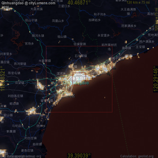
Analysis of Qinhuangdao night lights 2016
Square area 10x10 km:
 32.31%
90-99
29.08%80-89
5.44%70-79
6.8%60-69
3.57%50-59
4.08%40-49
3.23%30-39
6.29%20-29
7.82%10-19
1.36%0-9
0%Square area 50x50 km:
2.2%90-99
2.6%80-89
2.79%70-79
2.8%60-69
2.67%50-59
2.48%40-49
2.44%30-39
2.96%20-29
5.33%10-19
8.68%0-9
65.07%Clear (daylight) street map image can be seen on geolist.org.
Map coordinates:
40° 28' 7.4" North, 118° 53' 6.8" East
39° 55' 54" North, 119° 35' 18" East
39° 23' 25.4" North, 120° 17' 29.3" East
Some cities around Qinhuangdao sort by population:
• Shanhaiguan
15.8 km =9.8 mi,  60°
60°
• Linxi
100.3 km =62.3 mi,  255°
255°
• Zhaogezhuang
102.1 km =63.4 mi, 259°
• Tangjiazhuang
99.3 km =61.7 mi, 257°
• Beidaihehaibin
13.6 km =8.5 mi,  206°
206°
• Changli
45.1 km =28 mi,  235°
235°
• Songling
119.2 km =74.1 mi,  289°
289°
• Guye
100.5 km =62.4 mi, 257°
1797595 (p: 759,718)
Sources (retrieved 2019-11-25):
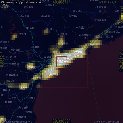
» NASA, Earths city lights 1995
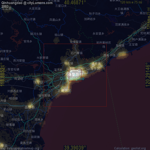
» NASA city lights 2003
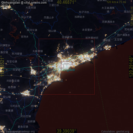
» Earth at Night: Flat Maps 2012, 2016