Qingdao night lights from space
Night Light of Qingdao (Shandong) from space (China) Src. Average luminocity for 10x10km area is 69.9158% and for 50x50km: 34.2007%.
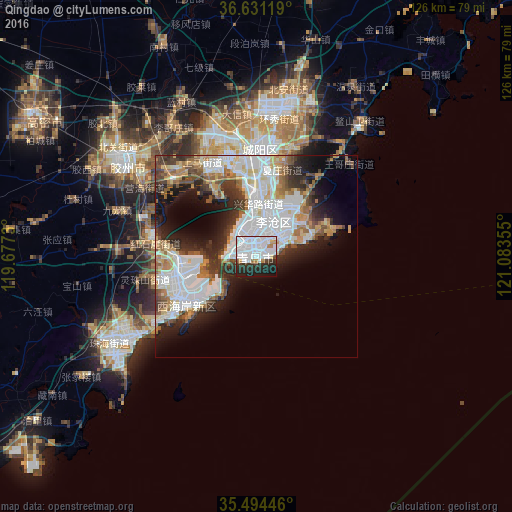
Analysis of Qingdao night lights 2016
Square area 10x10 km:
 43.96%
90-99
11.72%80-89
0.73%70-79
3.66%60-69
2.2%50-59
1.1%40-49
3.3%30-39
5.31%20-29
17.4%10-19
10.26%0-9
0.37%Square area 50x50 km:
11.65%90-99
7.11%80-89
2.94%70-79
2.99%60-69
3.83%50-59
3.26%40-49
3.27%30-39
4.39%20-29
7.13%10-19
9.44%0-9
43.98%Clear (daylight) street map image can be seen on geolist.org.
Map coordinates:
36° 37' 52.3" North, 119° 40' 38.3" East
36° 3' 53.6" North, 120° 22' 49.5" East
35° 29' 40.1" North, 121° 5' 0.8" East
Some cities around Qingdao sort by population:
• Zhu Cheng City
88.3 km =54.9 mi,  264°
264°
• Jiaozhou
41.7 km =25.9 mi,  305°
305°
• Gaomi
66.5 km =41.3 mi,  302°
302°
• Mizhou
88.7 km =55.1 mi, 264°
• Pingdu
88.9 km =55.2 mi,  334°
334°
• Laixi
89.3 km =55.5 mi,  8°
8°
• Yinzhu
41.9 km =26 mi,  240°
240°
• Jimo
36.9 km =22.9 mi, 11°
1797929 (p: 3,718,835)
Sources (retrieved 2019-11-25):
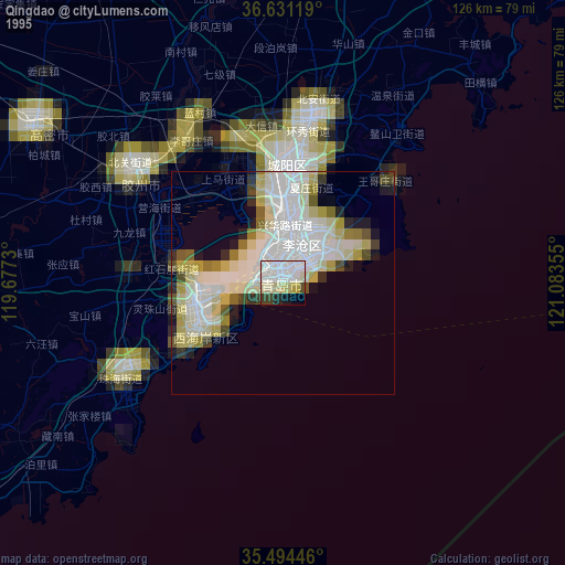
» NASA, Earths city lights 1995
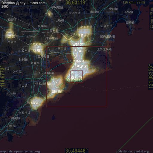
» NASA city lights 2003
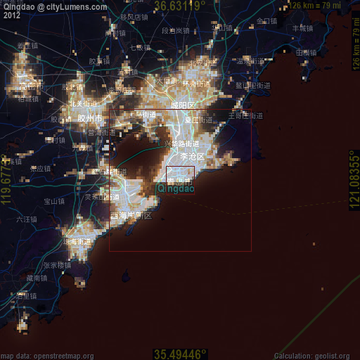
» Earth at Night: Flat Maps 2012, 2016