Dongyuan night lights from space
Night Light of Dongyuan (Fujian) from space (China) Src. Average luminocity for 10x10km area is 68.5019% and for 50x50km: 44.6805%.
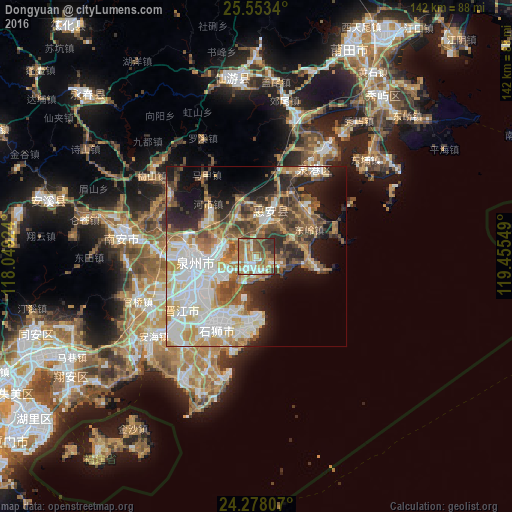
Analysis of Dongyuan night lights 2016
Square area 10x10 km:
 11.55%
90-99
14.39%80-89
4.17%70-79
13.64%60-69
21.59%50-59
15.72%40-49
9.09%30-39
6.06%20-29
3.79%10-19
0%0-9
0%Square area 50x50 km:
10.79%90-99
8.92%80-89
3.96%70-79
7.06%60-69
7.35%50-59
6.35%40-49
5.92%30-39
4.92%20-29
8.23%10-19
10.48%0-9
26.02%Clear (daylight) street map image can be seen on geolist.org.
Map coordinates:
25° 33' 12.2" North, 118° 2' 57.3" East
24° 55' 2.6" North, 118° 45' 8.5" East
24° 16' 41.1" North, 119° 27' 19.8" East
Some cities around Dongyuan sort by population:
• Quanzhou
16.8 km =10.4 mi,  268°
268°
• Ximeicun
37.8 km =23.5 mi,  281°
281°
• Jinjiang
21 km =13 mi,  238°
238°
• Luoyang
8.4 km =5.2 mi,  303°
303°
• Dazuocun
21.9 km =13.6 mi,  98°
98°
• Yongning
27.1 km =16.8 mi,  193°
193°
• Fengzhou
22.5 km =14 mi, 281°
• Tuzhai
10.8 km =6.7 mi,  47°
47°
1812091 (p: 6,100)
Sources (retrieved 2019-11-25):
» Earth at Night: Flat Maps 2012, 2016