Benxi night lights from space
Night Light of Benxi (Liaoning) from space (China) Src. Average luminocity for 10x10km area is 59.4156% and for 50x50km: 8.7316%.
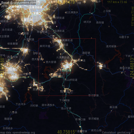
Analysis of Benxi night lights 2016
Square area 10x10 km:
 12.01%
90-99
12.5%80-89
13.8%70-79
4.06%60-69
8.28%50-59
7.79%40-49
5.68%30-39
10.55%20-29
13.31%10-19
11.2%0-9
0.81%Square area 50x50 km:
0.65%90-99
0.93%80-89
1.39%70-79
0.81%60-69
1.34%50-59
1.51%40-49
1.4%30-39
2.12%20-29
2.41%10-19
7%0-9
80.45%Clear (daylight) street map image can be seen on geolist.org.
Map coordinates:
41° 48' 53.2" North, 123° 3' 42.8" East
41° 17' 19" North, 123° 45' 54" East
40° 45' 29.3" North, 124° 28' 5.3" East
Some cities around Benxi sort by population:
• Shenyang
62.5 km =38.8 mi,  333°
333°
• Fushun
68.1 km =42.3 mi,  12°
12°
• Anshan
67.4 km =41.9 mi,  254°
254°
• Liaoyang
49.5 km =30.8 mi,  267°
267°
• Dongling
60.5 km =37.6 mi,  344°
344°
• Sujiatun
54.4 km =33.8 mi,  319°
319°
• Gongchangling
32.6 km =20.3 mi,  234°
234°
• Xiaoshi
29.7 km =18.5 mi,  88°
88°
2038300 (p: 987,717)
Sources (retrieved 2019-11-25):
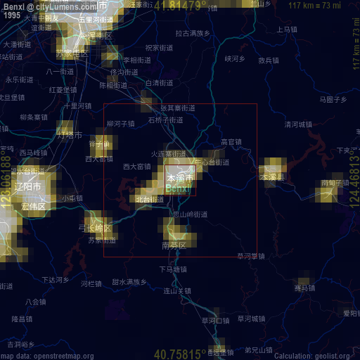
» NASA, Earths city lights 1995
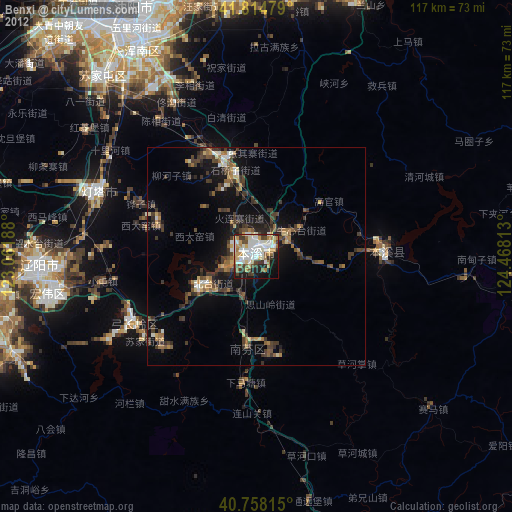
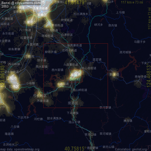
» NASA city lights 2003
» Earth at Night: Flat Maps 2012, 2016