Dietlikon / Dietlikon (Dorf) night lights from space
Night Light of Dietlikon / Dietlikon (Dorf) (Zurich) from space (Switzerland) Src. Average luminocity for 10x10km area is 54.4744% and for 50x50km: 15.624%.
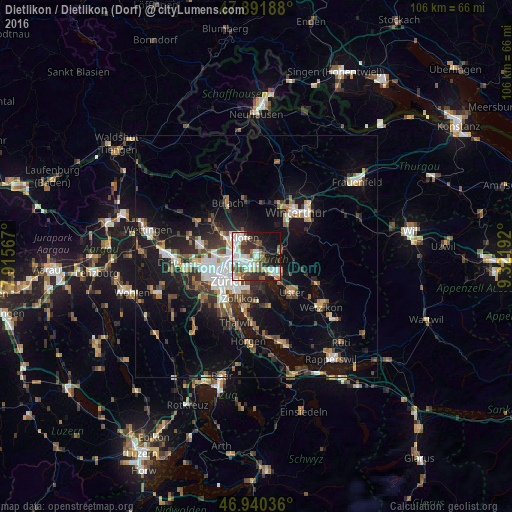
Analysis of Dietlikon / Dietlikon (Dorf) night lights 2016
Square area 10x10 km:
 15.06%
90-99
14.35%80-89
4.83%70-79
2.98%60-69
4.55%50-59
8.66%40-49
6.11%30-39
9.38%20-29
9.94%10-19
20.03%0-9
4.12%Square area 50x50 km:
2.61%90-99
2.47%80-89
1.23%70-79
1.38%60-69
2.05%50-59
1.72%40-49
2.56%30-39
2.74%20-29
4.05%10-19
12.2%0-9
66.99%Clear (daylight) street map image can be seen on geolist.org.
Map coordinates:
47° 53' 30.8" North, 7° 54' 56.4" East
47° 25' 5.8" North, 8° 37' 7.7" East
46° 56' 25.3" North, 9° 19' 18.9" East
Some cities around Dietlikon / Dietlikon (Dorf) sort by population:
• Zürich (Kreis 12)
3.6 km =2.2 mi,  243°
243°
• Dübendorf
2.3 km =1.4 mi,  180°
180°
• Wallisellen
1.7 km =1.1 mi,  257°
257°
• Zürich (Kreis 12) / Hirzenbach
3 km =1.9 mi,  233°
233°
• Zürich (Kreis 12) / Schwamendingen-Mitte
3.7 km =2.3 mi,  249°
249°
• Bassersdorf
2.9 km =1.8 mi,  14°
14°
• Zürich (Kreis 12) / Saatlen
4.1 km =2.5 mi, 259°
• Wallisellen / Wallisellen-Ost
1.7 km =1.1 mi, 255°
2661014 (p: 6,149)
Sources (retrieved 2019-11-25):
» Earth at Night: Flat Maps 2012, 2016