Belp night lights from space
Night Light of Belp (Bern) from space (Switzerland) Src. Average luminocity for 10x10km area is 19.4241% and for 50x50km: 7.114%.
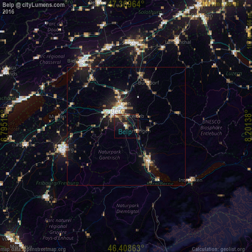
Analysis of Belp night lights 2016
Square area 10x10 km:
100  0.6%
0.6%
90-99 2.08%
80-89 1.49%
70-79 1.64%
60-69 3.42%
50-59 4.17%
40-49 4.61%
30-39 2.23%
20-29 7.74%
10-19 22.77%
0-9 49.26%
0.6%90-99
2.08%80-89
1.49%70-79
1.64%60-69
3.42%50-59
4.17%40-49
4.61%30-39
2.23%20-29
7.74%10-19
22.77%0-9
49.26%Square area 50x50 km:
100 0.54%
90-99 0.93%
80-89 0.66%
70-79 0.64%
60-69 0.89%
50-59 1.16%
40-49 1.49%
30-39 1.25%
20-29 2.33%
10-19 5.66%
0-9 84.45%
0.54%90-99
0.93%80-89
0.66%70-79
0.64%60-69
0.89%50-59
1.16%40-49
1.49%30-39
1.25%20-29
2.33%10-19
5.66%0-9
84.45%Clear (daylight) street map image can be seen on geolist.org.
Map coordinates:
47° 22' 10.7" North, 6° 47' 42.5" East
46° 53' 28.6" North, 7° 29' 53.7" East
46° 24' 31.1" North, 8° 12' 5" East
Some cities around Belp sort by population:
• Bern
7.4 km =4.6 mi,  328°
328°
• Köniz
7.3 km =4.5 mi,  300°
300°
• Muri
4.5 km =2.8 mi,  348°
348°
• Worb
6.5 km =4 mi,  48°
48°
• Münsingen
5.2 km =3.2 mi,  113°
113°
• Zollikofen
12.4 km =7.7 mi, 345°
• Bolligen
9.3 km =5.8 mi,  359°
359°
• Heimberg
13.4 km =8.3 mi,  143°
143°
2661563 (p: 9,307)
Sources (retrieved 2019-11-25):
» Earth at Night: Flat Maps 2012, 2016