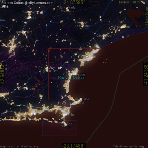
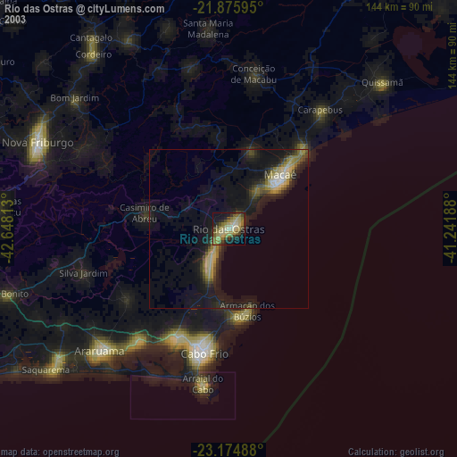
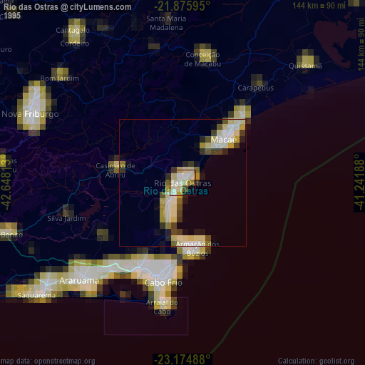
Rio das Ostras night lights from space
Night Light of Rio das Ostras (Rio de Janeiro) from space (Brazil) Src. Average luminocity for 10x10km area is 54.0095% and for 50x50km: 13.7232%.
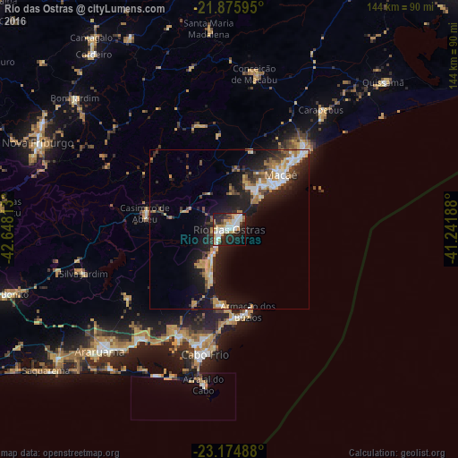
Analysis of Rio das Ostras night lights 2016
Square area 10x10 km:
 14.39%
90-99
12.88%80-89
5.87%70-79
8.52%60-69
6.06%50-59
1.14%40-49
4.73%30-39
5.68%20-29
18.18%10-19
18.75%0-9
3.79%Square area 50x50 km:
1.89%90-99
2.11%80-89
1.16%70-79
2.31%60-69
2.05%50-59
1.01%40-49
1.94%30-39
2.12%20-29
4.29%10-19
12.3%0-9
68.82%Clear (daylight) street map image can be seen on geolist.org.
Map coordinates:
21° 52' 33.4" South, 42° 38' 53.3" West
22° 31' 37" South, 41° 56' 42" West
23° 10' 29.6" South, 41° 14' 30.8" West
Some cities around Rio das Ostras sort by population:
• Macaé
22.9 km =14.2 mi,  46°
46°
• Cabo Frio
40.9 km =25.4 mi,  191°
191°
• São Pedro da Aldeia
38.3 km =23.8 mi,  204°
204°
• Arraial do Cabo
49.6 km =30.8 mi, 189°
• Armação de Búzios
25.3 km =15.7 mi,  165°
165°
• Casimiro de Abreu
27.1 km =16.8 mi,  280°
280°
• Silva Jardim
47.9 km =29.8 mi,  253°
253°
• Iguaba Grande
45.3 km =28.1 mi,  219°
219°
3451205 (p: 100,000)
Sources (retrieved 2019-11-25):
» NASA, Earths city lights 1995
» NASA city lights 2003
» Earth at Night: Flat Maps 2012, 2016