Cabo Frio night lights from space
Night Light of Cabo Frio (Rio de Janeiro) from space (Brazil) Src. Average luminocity for 10x10km area is 52.0754% and for 50x50km: 12.6769%.
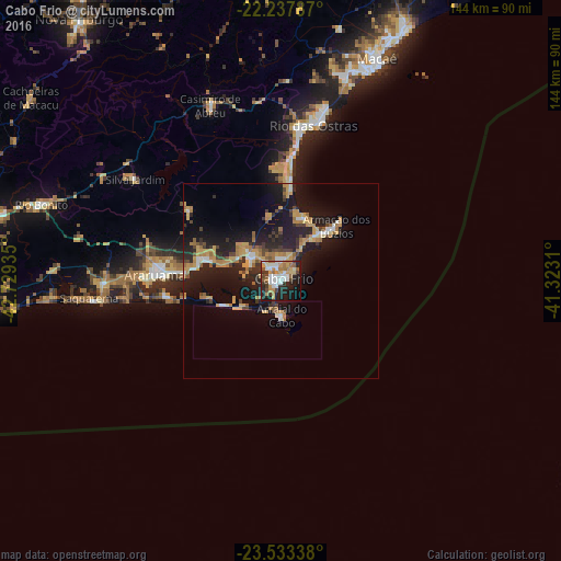
Analysis of Cabo Frio night lights 2016
Square area 10x10 km:
 10.52%
90-99
11.71%80-89
5.36%70-79
8.53%60-69
9.72%50-59
3.17%40-49
4.76%30-39
6.35%20-29
17.66%10-19
18.25%0-9
3.97%Square area 50x50 km:
1.05%90-99
1.36%80-89
1.34%70-79
2.97%60-69
2.52%50-59
0.8%40-49
1.57%30-39
1.49%20-29
4.66%10-19
12.65%0-9
69.59%Clear (daylight) street map image can be seen on geolist.org.
Map coordinates:
22° 14' 16.3" South, 42° 43' 45.7" West
22° 53' 13.8" South, 42° 1' 34.4" West
23° 32' 0.2" South, 41° 19' 23.2" West
Some cities around Cabo Frio sort by population:
• Araruama
32.5 km =20.2 mi,  272°
272°
• Rio das Ostras
40.9 km =25.4 mi,  11°
11°
• São Pedro da Aldeia
9.5 km =5.9 mi,  304°
304°
• Arraial do Cabo
8.8 km =5.5 mi,  181°
181°
• Armação de Búzios
21.5 km =13.4 mi,  43°
43°
• Casimiro de Abreu
48.8 km =30.3 mi,  338°
338°
• Silva Jardim
45.8 km =28.5 mi,  305°
305°
• Iguaba Grande
21.4 km =13.3 mi,  284°
284°
3468615 (p: 108,239)
Sources (retrieved 2019-11-25):
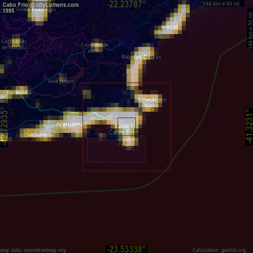
» NASA, Earths city lights 1995
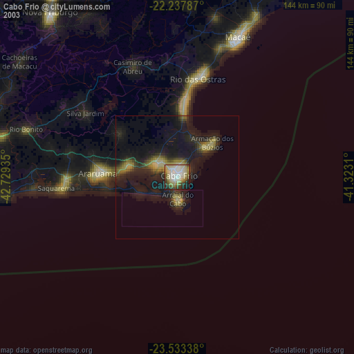
» NASA city lights 2003
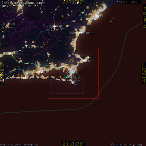
» Earth at Night: Flat Maps 2012, 2016