Belford Roxo night lights from space
Night Light of Belford Roxo (Rio de Janeiro) from space (Brazil) Src. Average luminocity for 10x10km area is 99.4504% and for 50x50km: 69.1424%.
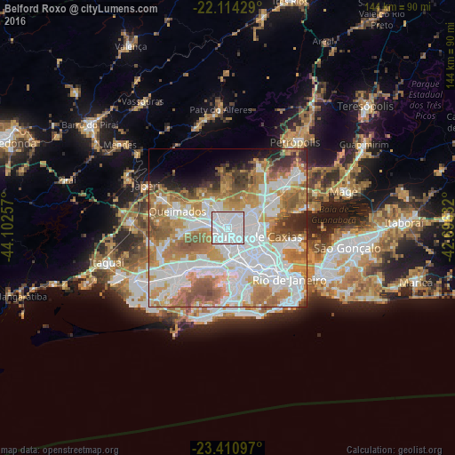

Analysis of Belford Roxo night lights 2016
Square area 10x10 km:
 83.93%
90-99
14.48%80-89
0.99%70-79
0.6%60-69
0%50-59
0%40-49
0%30-39
0%20-29
0%10-19
0%0-9
0%Square area 50x50 km:
24.33%90-99
15.43%80-89
4.69%70-79
11.86%60-69
12.4%50-59
8.35%40-49
3.97%30-39
3.32%20-29
3.26%10-19
3.49%0-9
8.91%Clear (daylight) street map image can be seen on geolist.org.
Map coordinates:
22° 6' 51.4" South, 44° 6' 9.3" West
22° 45' 51" South, 43° 23' 58" West
23° 24' 39.5" South, 42° 41' 46.8" West
Some cities around Belford Roxo sort by population:
• Rio de Janeiro
27.3 km =17 mi,  125°
125°
• Nova Iguaçu
5.3 km =3.3 mi,  275°
275°
• Duque de Caxias
9.3 km =5.8 mi,  104°
104°
• São João de Meriti
5.2 km =3.2 mi,  147°
147°
• Nilópolis
5 km =3.1 mi,  197°
197°
• Queimados
16.9 km =10.5 mi,  288°
288°
• Japeri
29.3 km =18.2 mi,  297°
297°
• Seropédica
31.7 km =19.7 mi,  274°
274°
3470142 (p: 466,096)
Sources (retrieved 2019-11-25):
» NASA, Earths city lights 1995
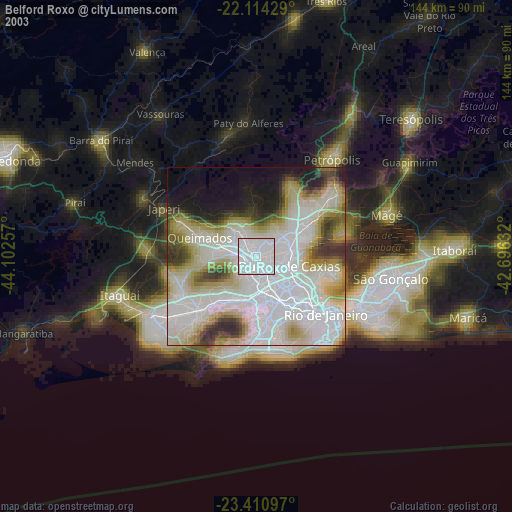
» NASA city lights 2003
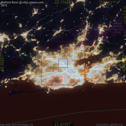
» Earth at Night: Flat Maps 2012, 2016