Itapira night lights from space
Night Light of Itapira (São Paulo) from space (Brazil) Src. Average luminocity for 10x10km area is 42.0852% and for 50x50km: 14.9555%.
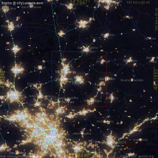

Analysis of Itapira night lights 2016
Square area 10x10 km:
 6.25%
6.25%90-99
7.01%80-89
7.01%70-79
7.01%60-69
3.98%50-59
5.87%40-49
6.82%30-39
3.22%20-29
6.63%10-19
43.75%0-9
2.46%Square area 50x50 km:
1.29%90-99
1.49%80-89
1.31%70-79
2.63%60-69
2.32%50-59
2.52%40-49
2.08%30-39
2.49%20-29
4.02%10-19
14.27%0-9
65.57%Clear (daylight) street map image can be seen on geolist.org.
Map coordinates:
21° 47' 4.9" South, 47° 31' 29.3" West
22° 26' 10" South, 46° 49' 18" West
23° 5' 4.1" South, 46° 7' 6.8" West
Some cities around Itapira sort by population:
• Mogi Guaçu
14.8 km =9.2 mi,  300°
300°
• Mogi Mirim
14 km =8.7 mi,  271°
271°
• Amparo
30 km =18.6 mi,  168°
168°
• Serra Negra
23.2 km =14.4 mi,  147°
147°
• Águas de Lindóia
19.9 km =12.4 mi,  102°
102°
• Jacutinga
27.3 km =17 mi,  52°
52°
• Santo Antônio de Posse
21.4 km =13.3 mi,  207°
207°
• Monte Sião
25.6 km =15.9 mi,  89°
89°
3460699 (p: 61,607)
Sources (retrieved 2019-11-25):
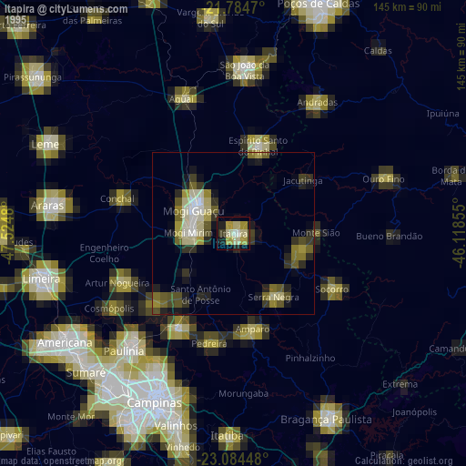
» NASA, Earths city lights 1995
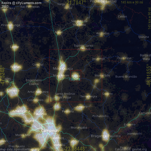
» NASA city lights 2003
» Earth at Night: Flat Maps 2012, 2016