Oostkamp night lights from space
Night Light of Oostkamp (Flanders) from space (Belgium) Src. Average luminocity for 10x10km area is 43.0882% and for 50x50km: 25.5341%.
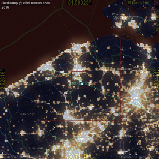
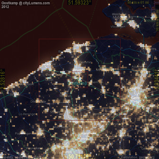
Analysis of Oostkamp night lights 2016
Square area 10x10 km:
 7.09%
7.09%90-99
9.36%80-89
6.68%70-79
5.08%60-69
4.01%50-59
1.07%40-49
5.75%30-39
8.16%20-29
21.12%10-19
25.53%0-9
6.15%Square area 50x50 km:
3.68%90-99
4.26%80-89
2.13%70-79
2.57%60-69
2.92%50-59
3.28%40-49
3.49%30-39
4.28%20-29
10.99%10-19
23.53%0-9
38.85%Clear (daylight) street map image can be seen on geolist.org.
Map coordinates:
51° 35' 35.6" North, 2° 31' 41.4" East
51° 9' 15.6" North, 3° 13' 52.6" East
50° 42' 40.3" North, 3° 56' 3.9" East
Some cities around Oostkamp sort by population:
• Brugge
6.1 km =3.8 mi,  355°
355°
• Zedelgem
6.7 km =4.2 mi,  258°
258°
• Sint-Kruis
6.8 km =4.2 mi,  10°
10°
• Beernem
7.7 km =4.8 mi,  102°
102°
• Jabbeke
10.4 km =6.5 mi,  287°
287°
• Wingene
11.1 km =6.9 mi,  164°
164°
• Damme
11.4 km =7.1 mi,  17°
17°
• Knesselare
12.8 km =8 mi, 97°
2789751 (p: 21,489)
Sources (retrieved 2019-11-25):
» Earth at Night: Flat Maps 2012, 2016