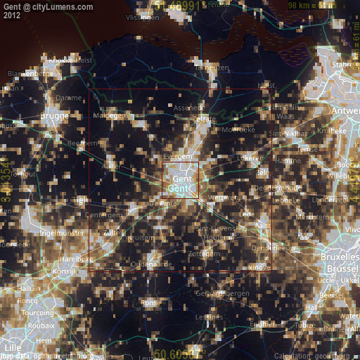
Gent night lights from space
Night Light of Gent (Flanders) from space (Belgium) Src. Average luminocity for 10x10km area is 89.4492% and for 50x50km: 39.2286%.

Analysis of Gent night lights 2016
Square area 10x10 km:
 39.3%
39.3%90-99
28.34%80-89
10.16%70-79
5.08%60-69
8.42%50-59
8.16%40-49
0.13%30-39
0.4%20-29
0%10-19
0%0-9
0%Square area 50x50 km:
4.72%90-99
5.86%80-89
3.8%70-79
4.95%60-69
5.94%50-59
8.06%40-49
8.71%30-39
8.16%20-29
13.87%10-19
20.79%0-9
15.14%Clear (daylight) street map image can be seen on geolist.org.
Map coordinates:
51° 29' 23.7" North, 3° 0' 48.7" East
51° 3' 0" North, 3° 43' 0" East
50° 36' 21.1" North, 4° 25' 11.2" East
Some cities around Gent sort by population:
• Evergem
7 km =4.3 mi,  356°
356°
• Merelbeke
6.5 km =4 mi,  161°
161°
• Destelbergen
5.9 km =3.7 mi,  79°
79°
• Melle
8.2 km =5.1 mi,  130°
130°
• De Pinte
7.9 km =4.9 mi,  217°
217°
• Lovendegem
9.2 km =5.7 mi,  308°
308°
• Ledeberg
2.3 km =1.4 mi,  123°
123°
• Sint-Martens-Latem
6.8 km =4.2 mi,  234°
234°
2797656 (p: 231,493)
Sources (retrieved 2019-11-25):
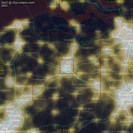
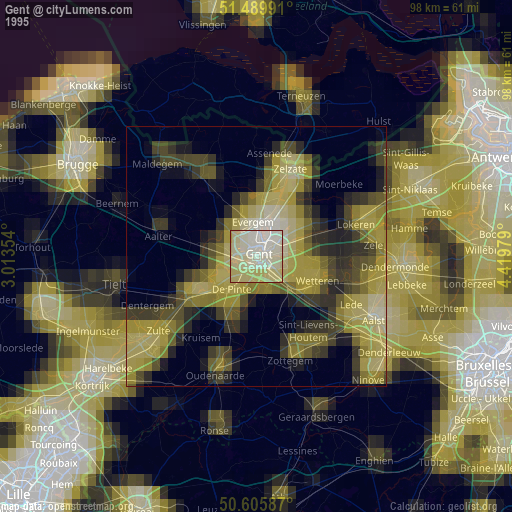
» NASA, Earths city lights 1995
» NASA city lights 2003
» Earth at Night: Flat Maps 2012, 2016