Bridgetown night lights from space
Night Light of Bridgetown (Saint Michael) from space (Barbados) Src. Average luminocity for 10x10km area is 58.5779% and for 50x50km: 11.2071%.
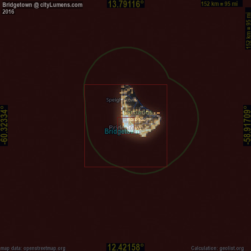
Analysis of Bridgetown night lights 2016
Square area 10x10 km:
 19.48%
90-99
16.67%80-89
10.39%70-79
4.11%60-69
2.16%50-59
0.65%40-49
2.16%30-39
2.16%20-29
18.83%10-19
17.97%0-9
5.41%Square area 50x50 km:
1.02%90-99
1.29%80-89
2.14%70-79
2.06%60-69
0.98%50-59
1.44%40-49
2.29%30-39
2.44%20-29
3.28%10-19
7.01%0-9
76.06%Clear (daylight) street map image can be seen on geolist.org.
Map coordinates:
13° 47' 28.2" North, 60° 19' 24" West
13° 6' 26.4" North, 59° 37' 12.8" West
12° 25' 17.7" North, 58° 55' 1.5" West
Some cities around Bridgetown sort by population:
• Speightstown
16.2 km =10.1 mi,  350°
350°
• Oistins
9 km =5.6 mi,  117°
117°
• Bathsheba
15.4 km =9.6 mi,  41°
41°
• Holetown
9 km =5.6 mi, 347°
• Crane
18.6 km =11.6 mi,  90°
90°
• Greenland
17.4 km =10.8 mi,  15°
15°
• Four Cross Roads
12.7 km =7.9 mi,  56°
56°
• Welchman Hall
10 km =6.2 mi,  28°
28°
3374036 (p: 98,511)
Sources (retrieved 2019-11-25):
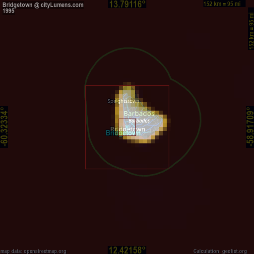
» NASA, Earths city lights 1995
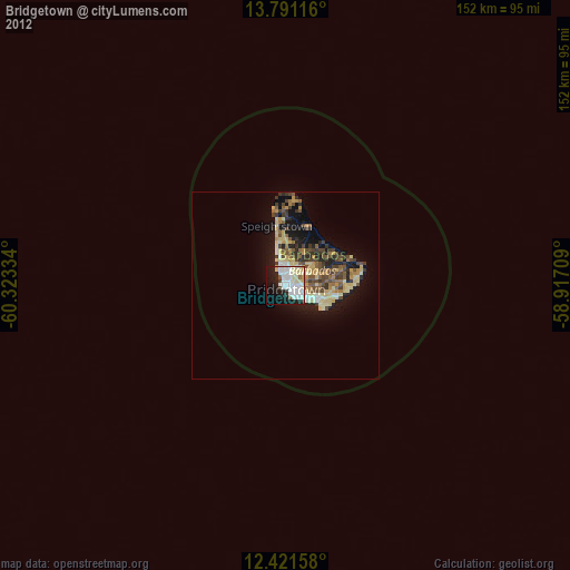
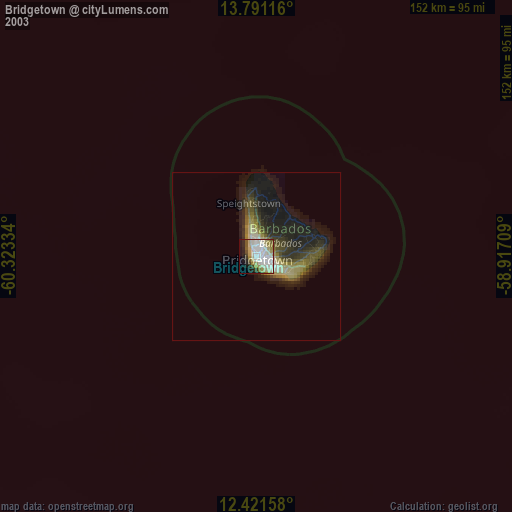
» NASA city lights 2003
» Earth at Night: Flat Maps 2012, 2016