Puerto Piray night lights from space
Night Light of Puerto Piray (Misiones) from space (Argentina) Src. Average luminocity for 10x10km area is 13.6799% and for 50x50km: 3.666%.
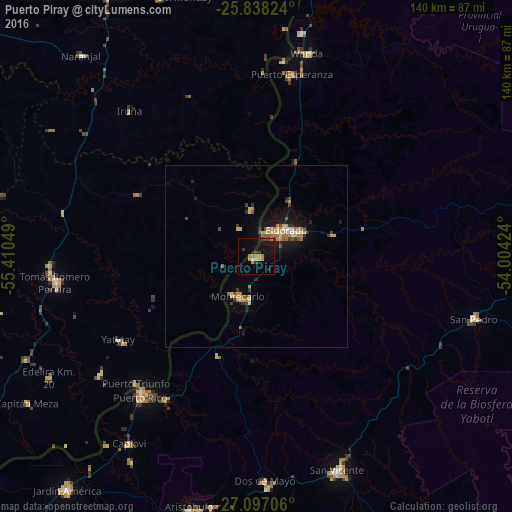
Analysis of Puerto Piray night lights 2016
Square area 10x10 km:
 0.38%
0.38%90-99
0.38%80-89
1.52%70-79
2.46%60-69
3.6%50-59
0.76%40-49
0.76%30-39
3.79%20-29
1.89%10-19
15.91%0-9
68.56%Square area 50x50 km:
0.15%90-99
0.2%80-89
0.65%70-79
0.67%60-69
0.84%50-59
0.3%40-49
0.4%30-39
0.62%20-29
0.54%10-19
3.09%0-9
92.54%Clear (daylight) street map image can be seen on geolist.org.
Map coordinates:
25° 50' 17.7" South, 55° 24' 37.8" West
26° 28' 9.7" South, 54° 42' 26.5" West
27° 5' 49.4" South, 54° 0' 15.3" West
Some cities around Puerto Piray sort by population:
• San Vicente
59.4 km =36.9 mi,  106°
106°
• San Pedro
61.9 km =38.5 mi, 105°
• Montecarlo
11.8 km =7.3 mi,  204°
204°
• Wanda
57.5 km =35.7 mi,  14°
14°
• Dos de Mayo
61.6 km =38.3 mi,  178°
178°
• Garuhapé
46 km =28.6 mi,  212°
212°
• Arquitecto Tomás Romero Pereira, PY
54 km =33.6 mi,  268°
268°
• El Alcázar
29.3 km =18.2 mi, 201°
3429738 (p: 8,557)
Sources (retrieved 2019-11-25):
» Earth at Night: Flat Maps 2012, 2016