Asheville night lights from space
Night Light of Asheville (North Carolina) from space (United States) Src. Average luminocity for 10x10km area is 72.8986% and for 50x50km: 15.7198%.
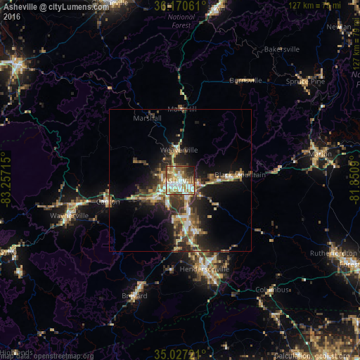
Analysis of Asheville night lights 2016
Square area 10x10 km:
 15.73%
90-99
19.41%80-89
12.59%70-79
8.74%60-69
13.11%50-59
13.29%40-49
6.82%30-39
2.8%20-29
5.24%10-19
2.27%0-9
0%Square area 50x50 km:
1.77%90-99
1.87%80-89
2.32%70-79
2.06%60-69
2.16%50-59
2.72%40-49
2.57%30-39
3.65%20-29
4.82%10-19
9.32%0-9
66.74%Clear (daylight) street map image can be seen on geolist.org.
Map coordinates:
36° 10' 14.2" North, 83° 15' 25.7" West
35° 36' 3.4" North, 82° 33' 14.5" West
35° 1' 38" North, 81° 51' 3.2" West
Some cities around Asheville sort by population:
• Hendersonville
32.5 km =20.2 mi,  164°
164°
• Waynesville
41.3 km =25.7 mi,  252°
252°
• Black Mountain
21.1 km =13.1 mi,  84°
84°
• Brevard
44 km =27.3 mi,  201°
201°
• Fletcher
19.5 km =12.1 mi,  165°
165°
• Mills River
23.7 km =14.7 mi,  182°
182°
• Etowah
31.7 km =19.7 mi,  186°
186°
• Woodfin
4.4 km =2.7 mi,  324°
324°
4453066 (p: 88,512)
Sources (retrieved 2019-11-25):
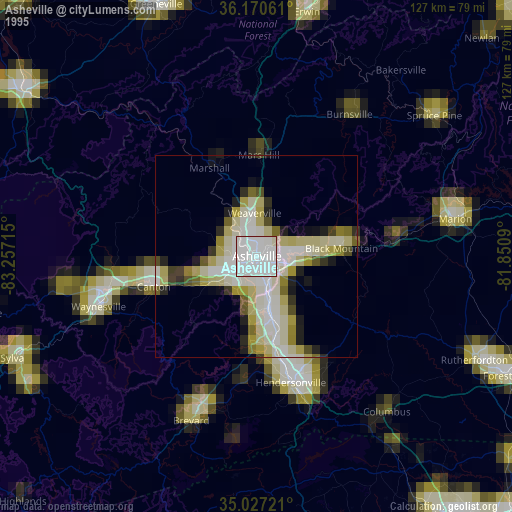
» NASA, Earths city lights 1995
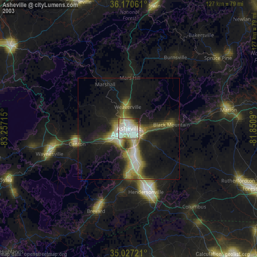
» NASA city lights 2003
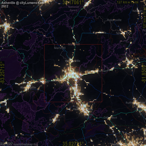
» Earth at Night: Flat Maps 2012, 2016