Narman night lights from space
Night Light of Narman (Erzurum) from space (Turkey) Src. Average luminocity for 10x10km area is 8.767% and for 50x50km: 1.0573%.
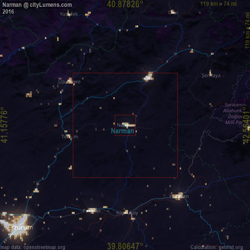
Analysis of Narman night lights 2016
Square area 10x10 km:
 1.36%
1.36%90-99
0.68%80-89
0.68%70-79
2.72%60-69
2.21%50-59
0.51%40-49
0%30-39
1.36%20-29
0%10-19
0%0-9
90.48%Square area 50x50 km:
0.15%90-99
0.09%80-89
0.14%70-79
0.16%60-69
0.18%50-59
0.09%40-49
0.13%30-39
0.23%20-29
0.18%10-19
0.11%0-9
98.54%Clear (daylight) street map image can be seen on geolist.org.
Map coordinates:
40° 52' 41.7" North, 41° 9' 27.9" East
40° 20' 40.2" North, 41° 51' 39.2" East
39° 48' 23.3" North, 42° 33' 50.4" East
Some cities around Narman sort by population:
• Erzurum
69.4 km =43.1 mi,  225°
225°
• Pasinler
43.7 km =27.2 mi,  201°
201°
• Sarıkamış
61.6 km =38.3 mi,  91°
91°
• Oltu
24.2 km =15 mi,  26°
26°
• Horasan
42.6 km =26.5 mi,  142°
142°
• Tortum
27.8 km =17.3 mi,  257°
257°
• Yusufeli
59.6 km =37 mi,  332°
332°
• Uzundere
34.4 km =21.4 mi,  307°
307°
741330 (p: 10,104)
Sources (retrieved 2019-11-25):
» Earth at Night: Flat Maps 2012, 2016