Puerto El Triunfo night lights from space
Night Light of Puerto El Triunfo (Usulután) from space (El Salvador) Src. Average luminocity for 10x10km area is 2.7975% and for 50x50km: 0.8561%.
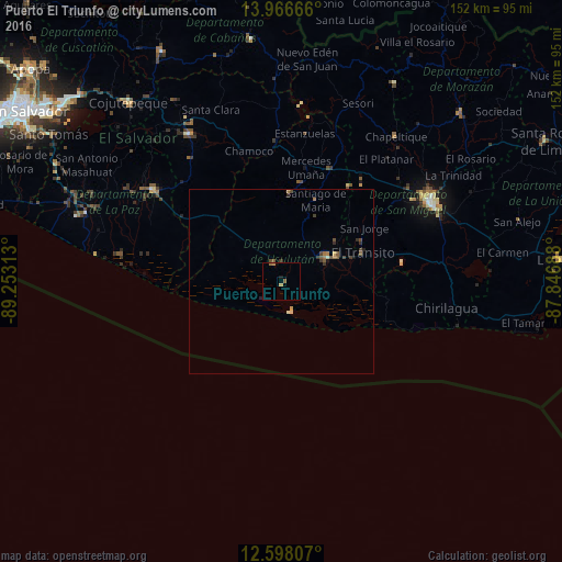
Analysis of Puerto El Triunfo night lights 2016
Square area 10x10 km:
 0%
0%90-99
0%80-89
0.41%70-79
1.24%60-69
0.83%50-59
0.83%40-49
0%30-39
0%20-29
0%10-19
1.03%0-9
95.66%Square area 50x50 km:
0%90-99
0.07%80-89
0.08%70-79
0.08%60-69
0.22%50-59
0.23%40-49
0.29%30-39
0.21%20-29
0.17%10-19
0.12%0-9
98.52%Clear (daylight) street map image can be seen on geolist.org.
Map coordinates:
13° 57' 60" North, 89° 15' 11.3" West
13° 16' 60" North, 88° 33' 0" West
12° 35' 53.1" North, 87° 50' 48.8" West
Some cities around Puerto El Triunfo sort by population:
• Usulután
13.1 km =8.1 mi,  55°
55°
• San Rafael Oriente
24.3 km =15.1 mi, 62°
• Santiago de María
24 km =14.9 mi,  22°
22°
• Berlín
24.2 km =15 mi,  4°
4°
• Jucuapa
31.6 km =19.6 mi,  34°
34°
• El Tránsito
22.9 km =14.2 mi,  71°
71°
• Jiquilisco
5.2 km =3.2 mi,  315°
315°
• Santa Elena
18.2 km =11.3 mi,  52°
52°
3584003 (p: 19,074)
Sources (retrieved 2019-11-25):
» Earth at Night: Flat Maps 2012, 2016