Östersund night lights from space
Night Light of Östersund (Jämtland) from space (Sweden) Src. Average luminocity for 10x10km area is 49.5871% and for 50x50km: 4.1036%.
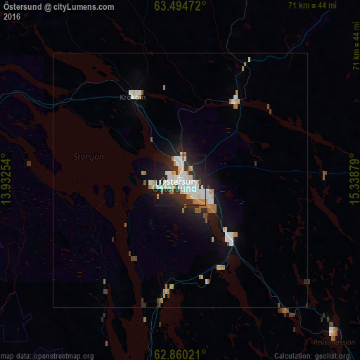
Analysis of Östersund night lights 2016
Square area 10x10 km:
 12.88%
90-99
16.1%80-89
5.21%70-79
4.17%60-69
3.69%50-59
0.95%40-49
0%30-39
4.55%20-29
22.44%10-19
24.43%0-9
5.59%Square area 50x50 km:
0.8%90-99
0.92%80-89
0.35%70-79
0.44%60-69
0.52%50-59
0.25%40-49
0.15%30-39
0.36%20-29
1.2%10-19
2.84%0-9
92.18%Clear (daylight) street map image can be seen on geolist.org.
Map coordinates:
63° 29' 41" North, 13° 55' 57.1" East
63° 10' 45.1" North, 14° 38' 8.4" East
62° 51' 36.8" North, 15° 20' 19.6" East
Some cities around Östersund sort by population:
• Sundsvall
161.6 km =100.4 mi,  122°
122°
• Timrå
156.8 km =97.4 mi, 119°
• Kvissleby
170.8 km =106.1 mi,  125°
125°
• Sollefteå
132 km =82 mi,  90°
90°
• Ljusdal
167.7 km =104.2 mi,  153°
153°
• Verdal, NO
170.8 km =106.1 mi,  293°
293°
• Kramfors
160.6 km =99.8 mi,  99°
99°
• Vi
163.8 km =101.8 mi, 120°
2685750 (p: 49,806)
Sources (retrieved 2019-11-25):
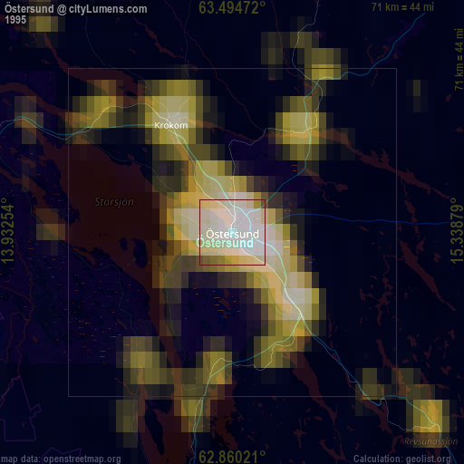
» NASA, Earths city lights 1995
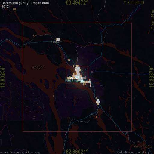
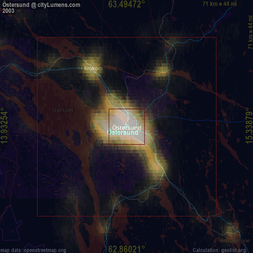
» NASA city lights 2003
» Earth at Night: Flat Maps 2012, 2016