Örebro night lights from space
Night Light of Örebro from space (Sweden) Src. Average luminocity for 10x10km area is 60.5996% and for 50x50km: 6.104%.
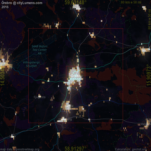
Analysis of Örebro night lights 2016
Square area 10x10 km:
 22.84%
90-99
19.81%80-89
4.44%70-79
3.25%60-69
3.14%50-59
1.95%40-49
0.97%30-39
6.6%20-29
15.69%10-19
16.23%0-9
5.09%Square area 50x50 km:
1.3%90-99
1.36%80-89
0.54%70-79
0.34%60-69
0.59%50-59
0.74%40-49
0.62%30-39
0.58%20-29
1.54%10-19
4.5%0-9
87.89%Clear (daylight) street map image can be seen on geolist.org.
Map coordinates:
59° 37' 53.3" North, 14° 30' 12.5" East
59° 16' 26.8" North, 15° 12' 23.8" East
58° 54' 46.7" North, 15° 54' 35" East
Some cities around Örebro sort by population:
• Karlskoga
39.2 km =24.4 mi,  278°
278°
• Köping
51.9 km =32.2 mi,  59°
59°
• Kumla
16.7 km =10.4 mi,  192°
192°
• Arboga
38.2 km =23.7 mi,  69°
69°
• Lindesberg
35.4 km =22 mi,  2°
2°
• Hallsberg
23.9 km =14.9 mi, 193°
• Degerfors
44.3 km =27.5 mi,  264°
264°
• Nora
28.8 km =17.9 mi,  340°
340°
2686657 (p: 115,765)
Sources (retrieved 2019-11-25):
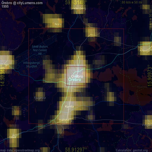
» NASA, Earths city lights 1995
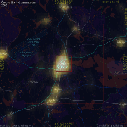
» NASA city lights 2003
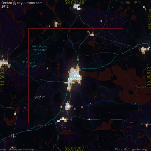
» Earth at Night: Flat Maps 2012, 2016