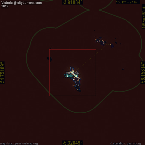
Victoria night lights from space
Night Light of Victoria (English River) from space (Seychelles) Src. Average luminocity for 10x10km area is 27.1467% and for 50x50km: 1.7364%.
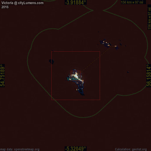
Analysis of Victoria night lights 2016
Square area 10x10 km:
 3.93%
3.93%90-99
5.17%80-89
4.13%70-79
2.48%60-69
3.72%50-59
1.65%40-49
3.31%30-39
4.34%20-29
0.62%10-19
32.44%0-9
38.22%Square area 50x50 km:
0.2%90-99
0.24%80-89
0.17%70-79
0.15%60-69
0.23%50-59
0.15%40-49
0.27%30-39
0.44%20-29
0.14%10-19
1.57%0-9
96.45%Clear (daylight) street map image can be seen on geolist.org.
Map coordinates:
3° 55' 7.8" South, 54° 45' 6.8" East
4° 37' 12" South, 55° 27' 18" East
5° 19' 13.8" South, 56° 9' 29.3" East
Some cities around Victoria sort by population:
• Anse Boileau
11.2 km =7 mi,  163°
163°
• Bel Ombre
4.3 km =2.7 mi,  274°
274°
• Beau Vallon
2.8 km =1.7 mi, 267°
• Cascade
7.2 km =4.5 mi,  136°
136°
• Anse Royale
14.3 km =8.9 mi,  151°
151°
• Takamaka
17.1 km =10.6 mi, 162°
• Port Glaud
6.7 km =4.2 mi,  219°
219°
• La Passe
51.6 km =32.1 mi,  54°
54°
241131 (p: 22,881)
Sources (retrieved 2019-11-25):
» Earth at Night: Flat Maps 2012, 2016