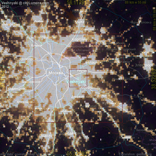
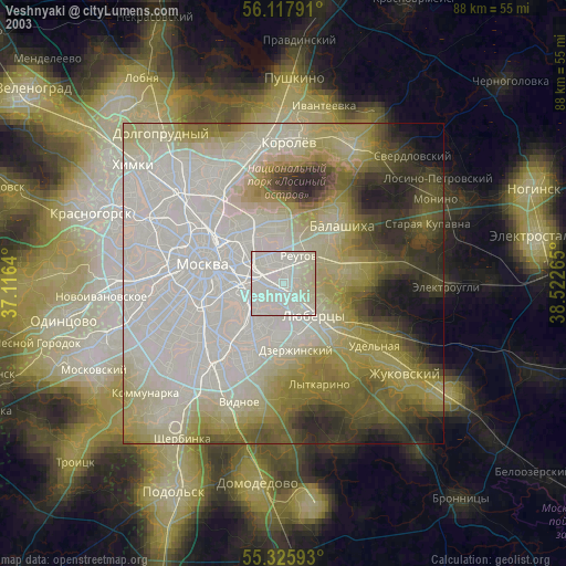
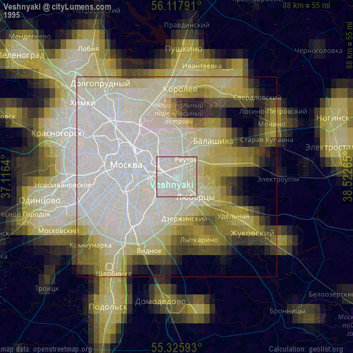
Veshnyaki night lights from space
Night Light of Veshnyaki (Moscow) from space (Russia) Src. Average luminocity for 10x10km area is 98.3923% and for 50x50km: 74.7961%.
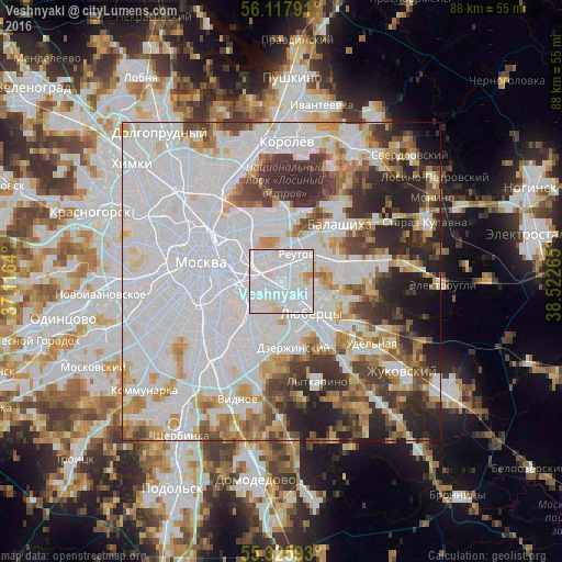
Analysis of Veshnyaki night lights 2016
Square area 10x10 km:
 71.77%
90-99
23.09%80-89
3.35%70-79
1.44%60-69
0.36%50-59
0%40-49
0%30-39
0%20-29
0%10-19
0%0-9
0%Square area 50x50 km:
37.44%90-99
15.58%80-89
5.31%70-79
6.17%60-69
5.3%50-59
4.42%40-49
5.25%30-39
6.31%20-29
8.26%10-19
4.98%0-9
0.98%Clear (daylight) street map image can be seen on geolist.org.
Map coordinates:
56° 7' 4.5" North, 37° 6' 59" East
55° 43' 26.1" North, 37° 49' 10.3" East
55° 19' 33.3" North, 38° 31' 21.5" East
Some cities around Veshnyaki sort by population:
• Vykhino-Zhulebino
2.5 km =1.6 mi,  191°
191°
• Zhulebino
3.3 km =2.1 mi,  144°
144°
• Kuz’minki
2.9 km =1.8 mi,  204°
204°
• Ivanovskoye
4.8 km =3 mi,  10°
10°
• Ryazanskiy
3.5 km =2.2 mi,  287°
287°
• Novogireyevo
3.3 km =2.1 mi,  359°
359°
• Novokuz’minki
2.4 km =1.5 mi,  250°
250°
• Kuskovo
1.2 km =0.7 mi,  19°
19°
473972 (p: 122,000)
Sources (retrieved 2019-11-25):
» NASA, Earths city lights 1995
» NASA city lights 2003
» Earth at Night: Flat Maps 2012, 2016