Taganskiy night lights from space
Night Light of Taganskiy (Moscow) from space (Russia) Src. Average luminocity for 10x10km area is 99.9486% and for 50x50km: 83.9224%.
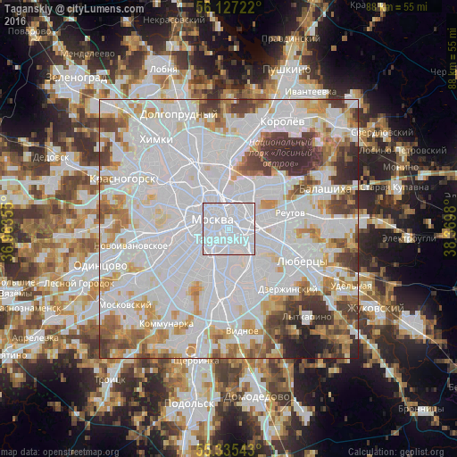
Analysis of Taganskiy night lights 2016
Square area 10x10 km:
 96.77%
90-99
3.23%80-89
0%70-79
0%60-69
0%50-59
0%40-49
0%30-39
0%20-29
0%10-19
0%0-9
0%Square area 50x50 km:
44.02%90-99
19.57%80-89
6.09%70-79
6.91%60-69
5.58%50-59
4.17%40-49
4.55%30-39
5.18%20-29
3.04%10-19
0.9%0-9
0%Clear (daylight) street map image can be seen on geolist.org.
Map coordinates:
56° 7' 38" North, 36° 57' 48.8" East
55° 43' 60" North, 37° 40' 0" East
55° 20' 7.5" North, 38° 22' 11.3" East
Some cities around Taganskiy sort by population:
• Moscow
3.8 km =2.4 mi,  303°
303°
• Novyye Kuz’minki
6.4 km =4 mi,  125°
125°
• Novyye Cherëmushki
6.4 km =4 mi,  234°
234°
• Ryazanskiy
6.3 km =3.9 mi,  90°
90°
• Tekstil’shchiki
6 km =3.7 mi, 127°
• Lefortovo
4.3 km =2.7 mi,  29°
29°
• Zamoskvorech’ye
2.1 km =1.3 mi,  270°
270°
• Kozhukhovo
3.7 km =2.3 mi,  180°
180°
484912 (p: 116,000)
Sources (retrieved 2019-11-25):
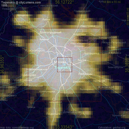
» NASA, Earths city lights 1995
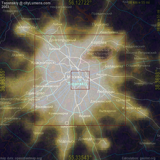
» NASA city lights 2003
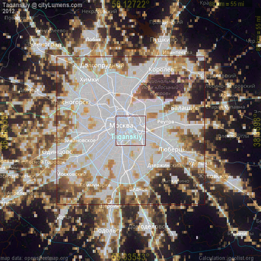
» Earth at Night: Flat Maps 2012, 2016