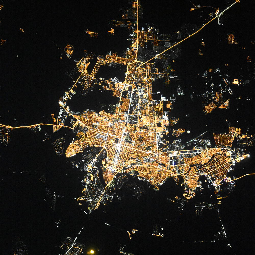
Krasnodar night lights from space
Night Light of Krasnodar (Krasnodarskiy) from space (Russia) Src. Average luminocity for 10x10km area is 94.1061% and for 50x50km: 24.77%.
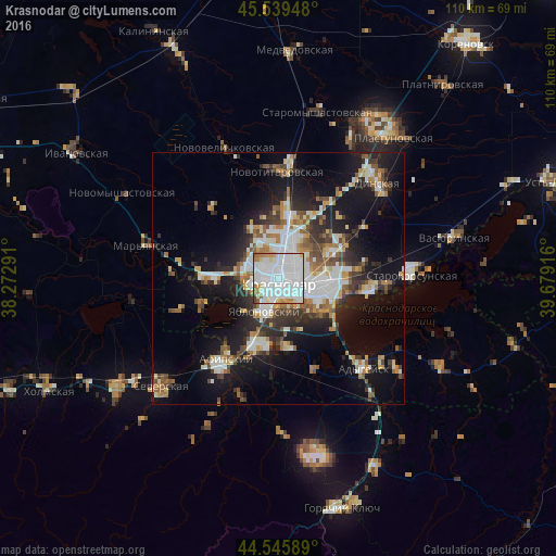
Analysis of Krasnodar night lights 2016
Square area 10x10 km:
 55.45%
90-99
27.58%80-89
3.33%70-79
3.33%60-69
6.97%50-59
2.12%40-49
0.61%30-39
0.61%20-29
0%10-19
0%0-9
0%Square area 50x50 km:
5.04%90-99
5.45%80-89
2.06%70-79
2.32%60-69
2.98%50-59
3.09%40-49
2.64%30-39
3.58%20-29
5.88%10-19
15.63%0-9
51.32%Clear (daylight) street map image can be seen on geolist.org.
Map coordinates:
45° 32' 22.1" North, 38° 16' 22.5" East
45° 2' 41.4" North, 38° 58' 33.7" East
44° 32' 45.2" North, 39° 40' 45" East
Fantastic image of Krasnodar from space taken by astronauts [src2], but I don't have information about it's orientation, scale or angle. If necessary, it was rotated manually, so North points approximately to upper direction. Click to zoom in:
Some cities around Krasnodar sort by population:
• Pashkovskiy
10.4 km =6.5 mi,  103°
103°
• Yablonovskiy
6.7 km =4.2 mi,  202°
202°
• Novotitarovskaya
21.4 km =13.3 mi,  0°
0°
• Yelizavetinskaya
14.2 km =8.8 mi,  270°
270°
• Afipskiy
19.2 km =11.9 mi,  213°
213°
• Enem
14.3 km =8.9 mi, 202°
• Adygeysk
24.6 km =15.3 mi,  136°
136°
• Takhtamukay
13.8 km =8.6 mi,  173°
173°
542420 (p: 649,851)
Sources (retrieved 2019-11-25):
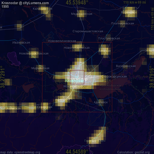
» NASA, Earths city lights 1995
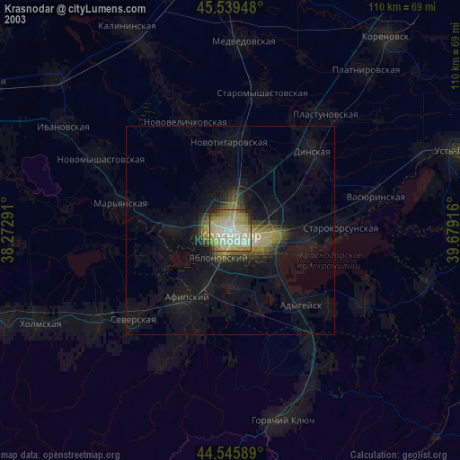
» NASA city lights 2003
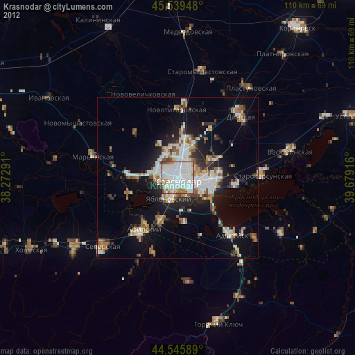
» Earth at Night: Flat Maps 2012, 2016
Src.2: picture by Oleg Kononenko,ĀRoscosmos, retrieved 2019-11-29