Kol’tsovo night lights from space
Night Light of Kol’tsovo (Novosibirsk Oblast) from space (Russia) Src. Average luminocity for 10x10km area is 55.4474% and for 50x50km: 26.3051%.
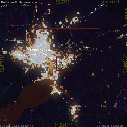
Analysis of Kol’tsovo night lights 2016
Square area 10x10 km:
 13.88%
90-99
13.4%80-89
6.22%70-79
5.86%60-69
6.7%50-59
3.35%40-49
2.63%30-39
14.83%20-29
19.74%10-19
11%0-9
2.39%Square area 50x50 km:
8.61%90-99
5.91%80-89
2.36%70-79
2.32%60-69
2.2%50-59
2.1%40-49
3.02%30-39
3.58%20-29
5.47%10-19
7.73%0-9
56.69%Clear (daylight) street map image can be seen on geolist.org.
Map coordinates:
55° 20' 22.2" North, 82° 28' 45.8" East
54° 56' 15.4" North, 83° 10' 57" East
54° 31' 53.9" North, 83° 53' 8.3" East
Some cities around Kol’tsovo sort by population:
• Novosibirsk
19.6 km =12.2 mi,  306°
306°
• Berdsk
21 km =13 mi,  195°
195°
• Akademgorodok
10.7 km =6.6 mi,  207°
207°
• Ob’
30.2 km =18.8 mi,  280°
280°
• Krasnoobsk
12.4 km =7.7 mi,  260°
260°
• Sokur
31.4 km =19.5 mi,  16°
16°
• Verkh-Tula
26.6 km =16.5 mi, 257°
• Baryshevo
2.1 km =1.3 mi,  359°
359°
1502847 (p: 9,976)
Sources (retrieved 2019-11-25):
» Earth at Night: Flat Maps 2012, 2016