Kodinsk night lights from space
Night Light of Kodinsk (Krasnoyarskiy) from space (Russia) Src. Average luminocity for 10x10km area is 9.7597% and for 50x50km: 2.6029%.
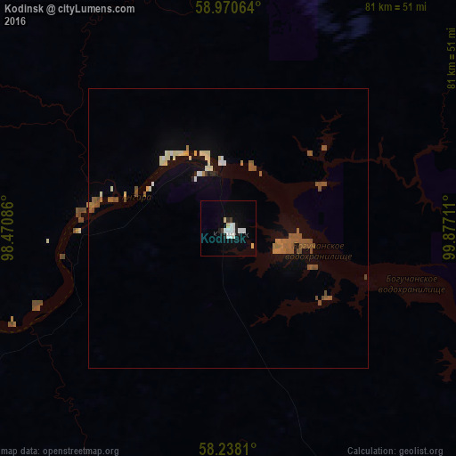
Analysis of Kodinsk night lights 2016
Square area 10x10 km:
 2.81%
2.81%90-99
2.38%80-89
1.08%70-79
0.22%60-69
0%50-59
0%40-49
0.22%30-39
0.65%20-29
1.41%10-19
2.27%0-9
88.96%Square area 50x50 km:
0.21%90-99
0.39%80-89
0.36%70-79
0.09%60-69
0.29%50-59
0.74%40-49
0.61%30-39
0.07%20-29
0.12%10-19
0.53%0-9
96.59%Clear (daylight) street map image can be seen on geolist.org.
Map coordinates:
58° 58' 14.3" North, 98° 28' 15.1" East
58° 36' 22.6" North, 99° 10' 26.3" East
58° 14' 17.2" North, 99° 52' 37.6" East
Some cities around Kodinsk sort by population:
• Ust’-Ilimsk
214.6 km =133.3 mi,  108°
108°
• Chunskiy
282.1 km =175.3 mi,  174°
174°
• Boguchany
103.1 km =64.1 mi,  255°
255°
• Aban
283 km =175.8 mi,  220°
220°
• Nizhnyaya Poyma
296 km =183.9 mi,  203°
203°
• Zheleznodorozhnyy
224.8 km =139.7 mi, 110°
• Motygino
265.2 km =164.8 mi, 259°
• Lesogorsk
285.4 km =177.3 mi,  175°
175°
1503037 (p: 15,670)
Sources (retrieved 2019-11-25):
» Earth at Night: Flat Maps 2012, 2016