Irkutsk night lights from space
Night Light of Irkutsk (Irkutsk Oblast) from space (Russia) Src. Average luminocity for 10x10km area is 87.2967% and for 50x50km: 13.4523%.
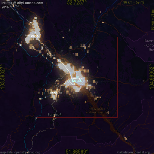
Analysis of Irkutsk night lights 2016
Square area 10x10 km:
 41.79%
90-99
28.79%80-89
4.29%70-79
3.66%60-69
7.45%50-59
5.43%40-49
4.17%30-39
3.41%20-29
0.76%10-19
0.25%0-9
0%Square area 50x50 km:
3.25%90-99
2.81%80-89
0.7%70-79
0.87%60-69
1.46%50-59
1.59%40-49
1.98%30-39
2.09%20-29
4.1%10-19
7.75%0-9
73.38%Clear (daylight) street map image can be seen on geolist.org.
Map coordinates:
52° 43' 32.5" North, 103° 35' 35.8" East
52° 17' 52" North, 104° 17' 47" East
51° 51' 56.5" North, 104° 59' 58.3" East
Fantastic image of Irkutsk from space taken by astronauts [src2], but I don't have information about it's orientation, scale or angle. If necessary, it was rotated manually, so North points approximately to upper direction. Click to zoom in:

Some cities around Irkutsk sort by population:
• Angarsk
38.5 km =23.9 mi,  313°
313°
• Usol’ye-Sibirskoye
67 km =41.6 mi,  318°
318°
• Shelekhov
16.3 km =10.1 mi,  235°
235°
• Slyudyanka
81.7 km =50.8 mi,  209°
209°
• Markova
11.5 km =7.1 mi, 210°
• Ust’-Ordynskiy
64.2 km =39.9 mi,  28°
28°
• Meget
21.2 km =13.2 mi, 307°
• Tayturka
85 km =52.8 mi, 318°
2023469 (p: 586,695)
Sources (retrieved 2019-11-25):
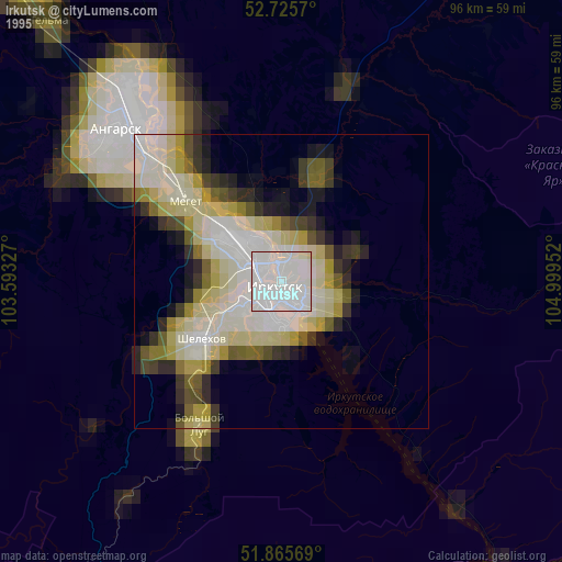
» NASA, Earths city lights 1995
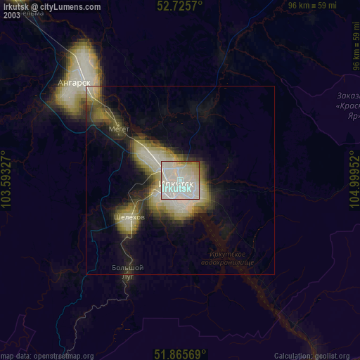
» NASA city lights 2003
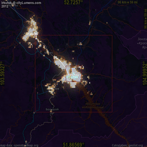
» Earth at Night: Flat Maps 2012, 2016
Src.2: picture by Oleg Kononenko, Roscosmos, retrieved 2019-11-29