Cherkessk night lights from space
Night Light of Cherkessk (Karachayevo-Cherkesiya Republic) from space (Russia) Src. Average luminocity for 10x10km area is 46.1106% and for 50x50km: 4.0402%.
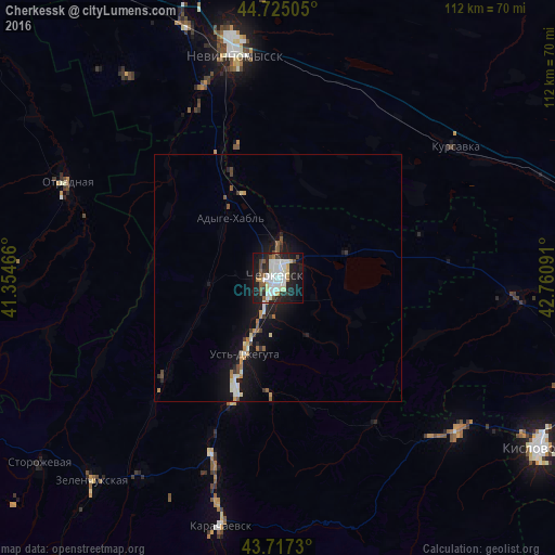
Analysis of Cherkessk night lights 2016
Square area 10x10 km:
 12.88%
90-99
12.73%80-89
5%70-79
1.52%60-69
1.82%50-59
5.76%40-49
3.33%30-39
3.48%20-29
15.45%10-19
30.15%0-9
7.88%Square area 50x50 km:
0.64%90-99
0.83%80-89
0.38%70-79
0.33%60-69
0.3%50-59
0.58%40-49
0.34%30-39
0.4%20-29
0.99%10-19
4.21%0-9
90.99%Clear (daylight) street map image can be seen on geolist.org.
Map coordinates:
44° 43' 30.2" North, 41° 21' 16.8" East
44° 13' 24" North, 42° 3' 28" East
43° 43' 2.3" North, 42° 45' 39.3" East
Some cities around Cherkessk sort by population:
• Ust’-Dzheguta
16.9 km =10.5 mi,  202°
202°
• Kursavka
44.3 km =27.5 mi,  54°
54°
• Ivanovskoye
42.1 km =26.2 mi,  340°
340°
• Psyzh
3.3 km =2.1 mi,  288°
288°
• Tereze
44.4 km =27.6 mi,  136°
136°
• Khabez
30.3 km =18.8 mi,  228°
228°
• Udobnaya
40.4 km =25.1 mi,  265°
265°
• Ali-Berdukovskiy
36.2 km =22.5 mi,  224°
224°
569154 (p: 116,224)
Sources (retrieved 2019-11-25):
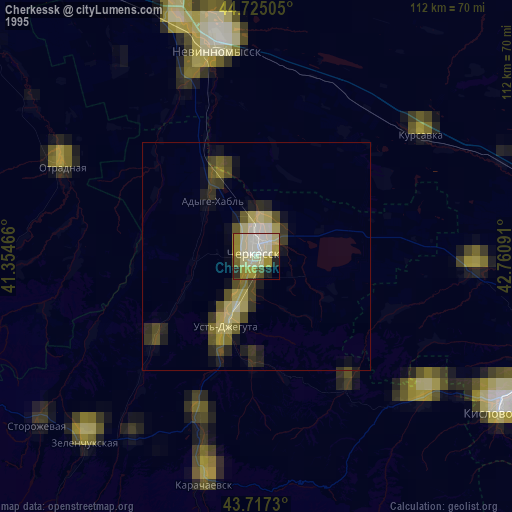
» NASA, Earths city lights 1995
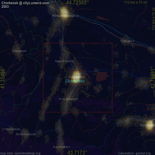
» NASA city lights 2003
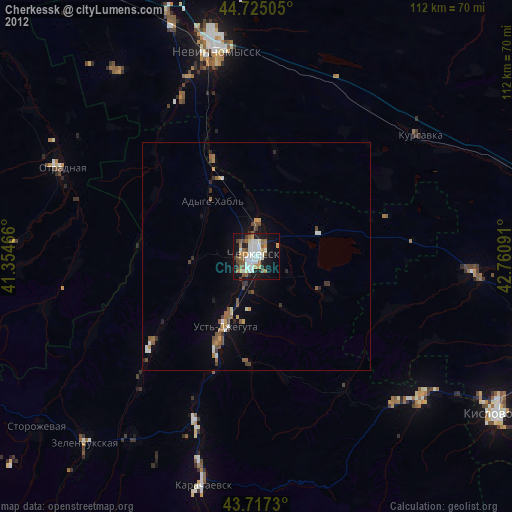
» Earth at Night: Flat Maps 2012, 2016