Uricani night lights from space
Night Light of Uricani (Hunedoara) from space (Romania) Src. Average luminocity for 10x10km area is 3.154% and for 50x50km: 0.8693%.
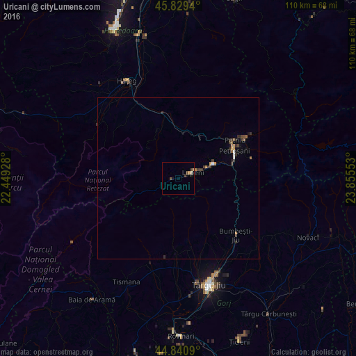
Analysis of Uricani night lights 2016
Square area 10x10 km:
 0%
0%90-99
0.63%80-89
0.32%70-79
0.63%60-69
0%50-59
1.43%40-49
0.48%30-39
0.63%20-29
0%10-19
1.27%0-9
94.6%Square area 50x50 km:
0.05%90-99
0.07%80-89
0.02%70-79
0.16%60-69
0.13%50-59
0.13%40-49
0.21%30-39
0.3%20-29
0.24%10-19
0.18%0-9
98.51%Clear (daylight) street map image can be seen on geolist.org.
Map coordinates:
45° 49' 45.8" North, 22° 26' 57.4" East
45° 20' 14.3" North, 23° 9' 8.6" East
44° 50' 27.2" North, 23° 51' 19.9" East
Some cities around Uricani sort by population:
• Târgu Jiu
33.6 km =20.9 mi,  162°
162°
• Petroşani
18.9 km =11.7 mi,  62°
62°
• Lupeni
7.2 km =4.5 mi,  69°
69°
• Vulcan
10.3 km =6.4 mi, 60°
• Petrila
24.1 km =15 mi, 58°
• Bumbeşti-Jiu
27.1 km =16.8 mi,  134°
134°
• Runcu
24.6 km =15.3 mi,  183°
183°
• Crasna
33.2 km =20.6 mi,  124°
124°
664163 (p: 9,924)
Sources (retrieved 2019-11-25):
» Earth at Night: Flat Maps 2012, 2016