Iernut night lights from space
Night Light of Iernut (Mureş) from space (Romania) Src. Average luminocity for 10x10km area is 0.7649% and for 50x50km: 1.706%.
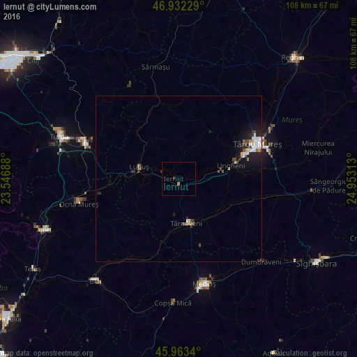
Analysis of Iernut night lights 2016
Square area 10x10 km:
 0%
0%90-99
0%80-89
0%70-79
0.3%60-69
0.3%50-59
0%40-49
0%30-39
0.6%20-29
0.3%10-19
0%0-9
98.51%Square area 50x50 km:
0.34%90-99
0.31%80-89
0.05%70-79
0.14%60-69
0.17%50-59
0.13%40-49
0.41%30-39
0.18%20-29
0.52%10-19
1.38%0-9
96.37%Clear (daylight) street map image can be seen on geolist.org.
Map coordinates:
46° 55' 56.2" North, 23° 32' 48.8" East
46° 27' 0" North, 24° 15' 0" East
45° 57' 48.2" North, 24° 57' 11.3" East
Some cities around Iernut sort by population:
• Târnăveni
13.6 km =8.5 mi,  164°
164°
• Luduş
12.1 km =7.5 mi,  287°
287°
• Band
18 km =11.2 mi,  34°
34°
• Ungheni
17 km =10.6 mi,  77°
77°
• Sâncraiu de Mureş
24 km =14.9 mi,  62°
62°
• Adămuş
16.7 km =10.4 mi,  184°
184°
• Pănet
20.5 km =12.7 mi, 55°
• Cristeşti
18.7 km =11.6 mi,  72°
72°
675727 (p: 9,343)
Sources (retrieved 2019-11-25):
» Earth at Night: Flat Maps 2012, 2016