Horodnic de Sus night lights from space
Night Light of Horodnic de Sus (Suceava) from space (Romania) Src. Average luminocity for 10x10km area is 3.1414% and for 50x50km: 0.6787%.
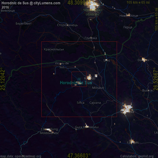
Analysis of Horodnic de Sus night lights 2016
Square area 10x10 km:
 0%
0%90-99
0%80-89
0%70-79
0%60-69
0%50-59
0.89%40-49
2.68%30-39
1.34%20-29
1.04%10-19
0%0-9
94.05%Square area 50x50 km:
0.07%90-99
0.11%80-89
0%70-79
0.05%60-69
0.14%50-59
0.15%40-49
0.15%30-39
0.14%20-29
0.08%10-19
0.08%0-9
99.03%Clear (daylight) street map image can be seen on geolist.org.
Map coordinates:
48° 18' 35.7" North, 25° 7' 13.5" East
47° 50' 24.4" North, 25° 49' 24.7" East
47° 21' 57.7" North, 26° 31' 36" East
Some cities around Horodnic de Sus sort by population:
• Rădăuți
7 km =4.3 mi,  81°
81°
• Marginea
2.7 km =1.7 mi,  191°
191°
• Milişăuţi
14.6 km =9.1 mi,  115°
115°
• Volovăţ
6.3 km =3.9 mi,  114°
114°
• Arbore
14.4 km =8.9 mi,  145°
145°
• Gălăneşti
8.7 km =5.4 mi,  348°
348°
• Vicovu de Jos
9.5 km =5.9 mi,  314°
314°
• Frătăuţii Noi
11.5 km =7.1 mi,  7°
7°
675983 (p: 5,136)
Sources (retrieved 2019-11-25):
» Earth at Night: Flat Maps 2012, 2016