Gherăeşti night lights from space
Night Light of Gherăeşti (Neamţ) from space (Romania) Src. Average luminocity for 10x10km area is 0.5085% and for 50x50km: 1.2436%.
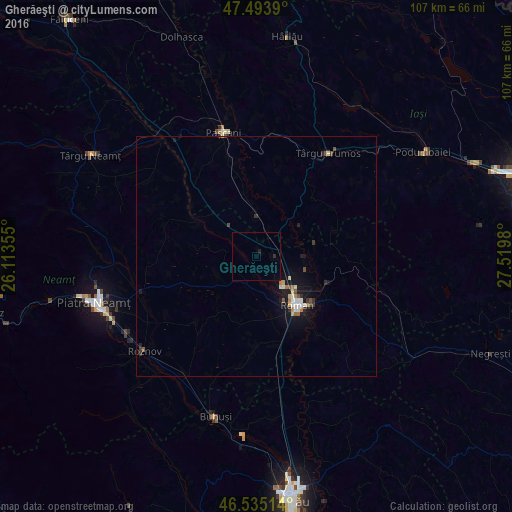
Analysis of Gherăeşti night lights 2016
Square area 10x10 km:
100  0%
0%
90-99 0%
80-89 0%
70-79 0%
60-69 0%
50-59 0%
40-49 0%
30-39 0%
20-29 0.57%
10-19 0.57%
0-9 98.86%
0%90-99
0%80-89
0%70-79
0%60-69
0%50-59
0%40-49
0%30-39
0%20-29
0.57%10-19
0.57%0-9
98.86%Square area 50x50 km:
100 0.13%
90-99 0.18%
80-89 0.12%
70-79 0.13%
60-69 0.14%
50-59 0.1%
40-49 0.23%
30-39 0.15%
20-29 0.23%
10-19 1.21%
0-9 97.37%
0.13%90-99
0.18%80-89
0.12%70-79
0.13%60-69
0.14%50-59
0.1%40-49
0.23%30-39
0.15%20-29
0.23%10-19
1.21%0-9
97.37%Clear (daylight) street map image can be seen on geolist.org.
Map coordinates:
47° 29' 38" North, 26° 6' 48.8" East
47° 1' 0" North, 26° 49' 0" East
46° 32' 6.5" North, 27° 31' 11.3" East
Some cities around Gherăeşti sort by population:
• Roman
13.5 km =8.4 mi,  141°
141°
• Săbăoani
3.7 km =2.3 mi,  99°
99°
• Tămăşeni
9.6 km =6 mi,  112°
112°
• Doljeşti
12.8 km =8 mi,  81°
81°
• Cordun
8.3 km =5.2 mi,  152°
152°
• Mirceşti
7.5 km =4.7 mi,  9°
9°
• Hălăuceşti
9.4 km =5.8 mi,  352°
352°
• Trifeşti
11.1 km =6.9 mi,  180°
180°
677454 (p: 6,448)
Sources (retrieved 2019-11-25):
» Earth at Night: Flat Maps 2012, 2016