Dancu night lights from space
Night Light of Dancu (Iaşi) from space (Romania) Src. Average luminocity for 10x10km area is 26.1847% and for 50x50km: 3.652%.
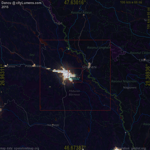
Analysis of Dancu night lights 2016
Square area 10x10 km:
100  5.82%
5.82%
90-99 7.24%
80-89 2.27%
70-79 1.14%
60-69 1.7%
50-59 2.7%
40-49 3.69%
30-39 1.14%
20-29 11.22%
10-19 15.63%
0-9 47.44%
5.82%90-99
7.24%80-89
2.27%70-79
1.14%60-69
1.7%50-59
2.7%40-49
3.69%30-39
1.14%20-29
11.22%10-19
15.63%0-9
47.44%Square area 50x50 km:
100 1.02%
90-99 0.64%
80-89 0.14%
70-79 0.23%
60-69 0.19%
50-59 0.39%
40-49 0.48%
30-39 0.47%
20-29 1.35%
10-19 2.78%
0-9 92.3%
1.02%90-99
0.64%80-89
0.14%70-79
0.23%60-69
0.19%50-59
0.39%40-49
0.48%30-39
0.47%20-29
1.35%10-19
2.78%0-9
92.3%Clear (daylight) street map image can be seen on geolist.org.
Map coordinates:
47° 37' 48.6" North, 26° 57' 47.2" East
47° 9' 15" North, 27° 39' 58.4" East
46° 40' 25.9" North, 28° 22' 9.7" East
Some cities around Dancu sort by population:
• Iaşi
5.2 km =3.2 mi,  285°
285°
• Ungheni, MD
11.9 km =7.4 mi,  58°
58°
• Tomeşti
4.4 km =2.7 mi,  162°
162°
• Holboca
2.6 km =1.6 mi,  100°
100°
• Ciurea
13.8 km =8.6 mi,  213°
213°
• Miroslava
11.3 km =7 mi,  267°
267°
• Leţcani
19.1 km =11.9 mi,  279°
279°
• Rediu
14.4 km =8.9 mi,  298°
298°
679767 (p: 6,903)
Sources (retrieved 2019-11-25):
» Earth at Night: Flat Maps 2012, 2016