Constanţa night lights from space
Night Light of Constanţa (Constanța) from space (Romania) Src. Average luminocity for 10x10km area is 61.3773% and for 50x50km: 7.5291%.
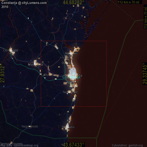

Analysis of Constanţa night lights 2016
Square area 10x10 km:
 21.21%
90-99
20.76%80-89
4.09%70-79
3.18%60-69
2.88%50-59
3.94%40-49
2.42%30-39
5%20-29
21.36%10-19
13.48%0-9
1.67%Square area 50x50 km:
1.17%90-99
1.47%80-89
0.58%70-79
0.59%60-69
0.93%50-59
1.04%40-49
1.08%30-39
0.69%20-29
2.69%10-19
5.66%0-9
84.12%Clear (daylight) street map image can be seen on geolist.org.
Map coordinates:
44° 40' 58.2" North, 27° 55' 52.3" East
44° 10' 50.6" North, 28° 38' 3.6" East
43° 40' 27.6" North, 29° 20' 14.8" East
Some cities around Constanţa sort by population:
• Năvodari
15.4 km =9.6 mi,  349°
349°
• Ovidiu
10.4 km =6.5 mi,  325°
325°
• Murfatlar
17.4 km =10.8 mi,  270°
270°
• Cumpăna
8.9 km =5.5 mi,  217°
217°
• Valu lui Traian
13.5 km =8.4 mi,  263°
263°
• Lumina
12.6 km =7.8 mi, 334°
• Techirghiol
14.8 km =9.2 mi,  190°
190°
• Agigea
10 km =6.2 mi, 190°
680963 (p: 303,399)
Sources (retrieved 2019-11-25):
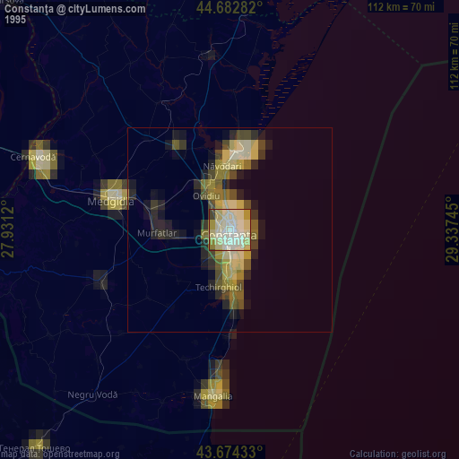
» NASA, Earths city lights 1995
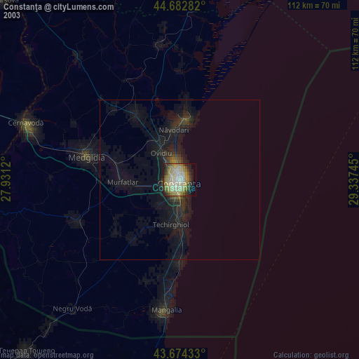
» NASA city lights 2003
» Earth at Night: Flat Maps 2012, 2016