Brăila night lights from space
Night Light of Brăila from space (Romania) Src. Average luminocity for 10x10km area is 42.5273% and for 50x50km: 6.251%.
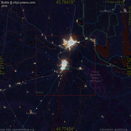
Analysis of Brăila night lights 2016
Square area 10x10 km:
 11.36%
90-99
12.42%80-89
2.58%70-79
4.55%60-69
2.42%50-59
3.48%40-49
3.64%30-39
2.73%20-29
12.73%10-19
24.09%0-9
20%Square area 50x50 km:
1.2%90-99
1.3%80-89
0.32%70-79
0.5%60-69
0.7%50-59
0.73%40-49
0.75%30-39
0.78%20-29
2.13%10-19
4.92%0-9
86.67%Clear (daylight) street map image can be seen on geolist.org.
Map coordinates:
45° 45' 51.1" North, 27° 16' 16.2" East
45° 16' 17.5" North, 27° 58' 27.4" East
44° 46' 28.3" North, 28° 40' 38.7" East
Some cities around Brăila sort by population:
• Galaţi
19.3 km =12 mi,  17°
17°
• Măcin
13 km =8.1 mi,  103°
103°
• Luncaviţa
22.9 km =14.2 mi,  86°
86°
• Tufeşti
27.6 km =17.1 mi,  206°
206°
• Jijila
14.1 km =8.8 mi,  77°
77°
• Greci
22.5 km =14 mi,  115°
115°
• Tudor Vladimirescu
14.9 km =9.3 mi,  245°
245°
• Chiscani
10.3 km =6.4 mi,  198°
198°
683902 (p: 213,569)
Sources (retrieved 2019-11-25):
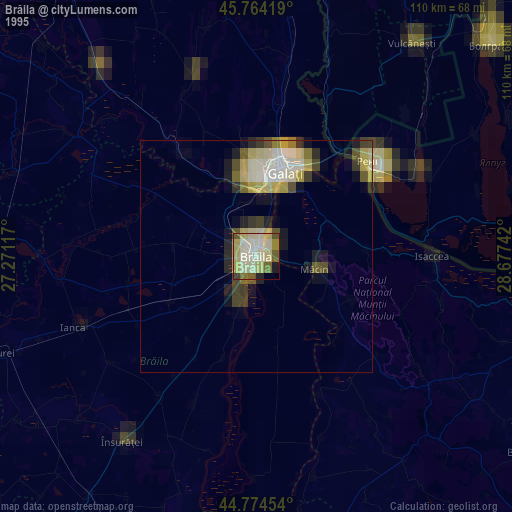
» NASA, Earths city lights 1995
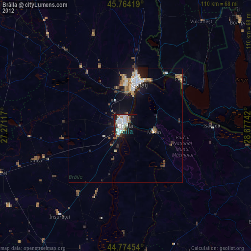
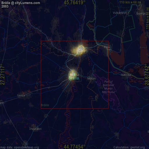
» NASA city lights 2003
» Earth at Night: Flat Maps 2012, 2016