Bedum night lights from space
Night Light of Bedum (Groningen) from space (Netherlands) Src. Average luminocity for 10x10km area is 5.1338% and for 50x50km: 5.8998%.
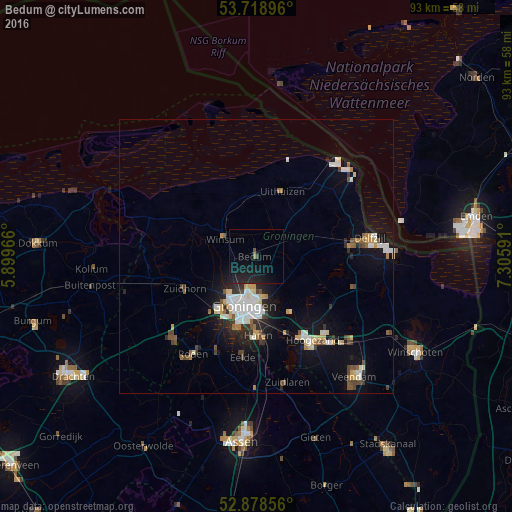
Analysis of Bedum night lights 2016
Square area 10x10 km:
 0%
0%90-99
0%80-89
0%70-79
0%60-69
0.51%50-59
0.38%40-49
0.13%30-39
0.51%20-29
4.29%10-19
15.03%0-9
79.17%Square area 50x50 km:
0.98%90-99
1.16%80-89
0.56%70-79
0.6%60-69
0.42%50-59
0.68%40-49
0.66%30-39
0.64%20-29
1.19%10-19
4.19%0-9
88.91%Clear (daylight) street map image can be seen on geolist.org.
Map coordinates:
53° 43' 8.3" North, 5° 53' 58.8" East
53° 18' 3" North, 6° 36' 10" East
52° 52' 42.8" North, 7° 18' 21.3" East
Some cities around Bedum sort by population:
• Groningen
9.4 km =5.8 mi,  194°
194°
• Korrewegwijk
8 km =5 mi,  196°
196°
• Appingedam
17.1 km =10.6 mi,  82°
82°
• Oosterpark
8.7 km =5.4 mi, 187°
• Haren
14.3 km =8.9 mi,  178°
178°
• Zuidhorn
14.6 km =9.1 mi,  245°
245°
• Selwerd
8 km =5 mi, 203°
• Helpman
11.5 km =7.1 mi, 187°
2759356 (p: 7,765)
Sources (retrieved 2019-11-25):
» Earth at Night: Flat Maps 2012, 2016