Eiguliai night lights from space
Night Light of Eiguliai (Kaunas) from space (Lithuania) Src. Average luminocity for 10x10km area is 70.9426% and for 50x50km: 7.0347%.
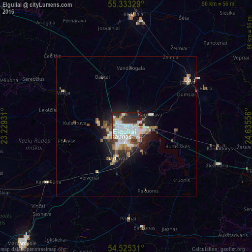

Analysis of Eiguliai night lights 2016
Square area 10x10 km:
 27.63%
90-99
22.13%80-89
6.1%70-79
4.55%60-69
3.71%50-59
4.07%40-49
3.11%30-39
8.61%20-29
12.92%10-19
7.18%0-9
0%Square area 50x50 km:
1.56%90-99
1.44%80-89
0.63%70-79
0.77%60-69
0.68%50-59
0.87%40-49
0.79%30-39
0.93%20-29
1.87%10-19
3.66%0-9
86.81%Clear (daylight) street map image can be seen on geolist.org.
Map coordinates:
55° 19' 59.8" North, 23° 13' 45.5" East
54° 55' 52.8" North, 23° 55' 56.7" East
54° 31' 31.1" North, 24° 38' 8" East
Some cities around Eiguliai sort by population:
• Kaunas
3.5 km =2.2 mi,  204°
204°
• Dainava (Kaunas)
2.9 km =1.8 mi,  127°
127°
• Šilainiai
3 km =1.9 mi,  265°
265°
• Jonava
28 km =17.4 mi,  52°
52°
• Aleksotas
5.9 km =3.7 mi, 195°
• Garliava
12.8 km =8 mi, 197°
• Prienai
32.8 km =20.4 mi,  178°
178°
• Kazlų Rūda
34.8 km =21.6 mi,  234°
234°
9610008 (p: 61,700)
Sources (retrieved 2019-11-25):
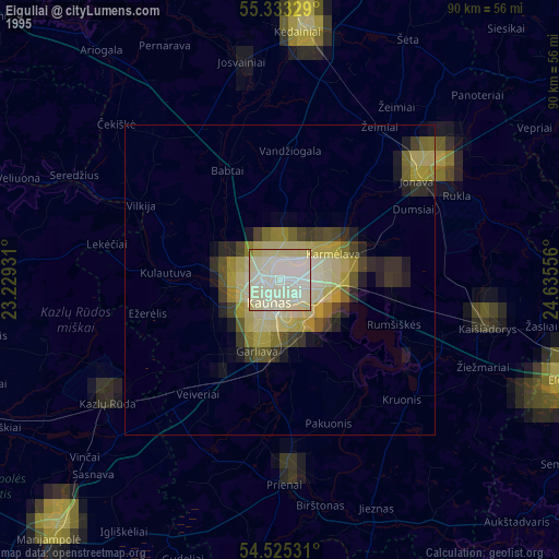
» NASA, Earths city lights 1995
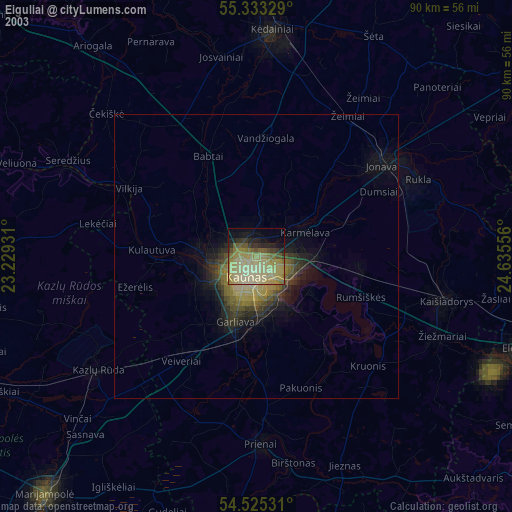
» NASA city lights 2003
» Earth at Night: Flat Maps 2012, 2016