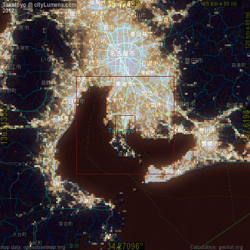
Taketoyo night lights from space
Night Light of Taketoyo (Aichi) from space (Japan) Src. Average luminocity for 10x10km area is 57.3168% and for 50x50km: 36.9266%.
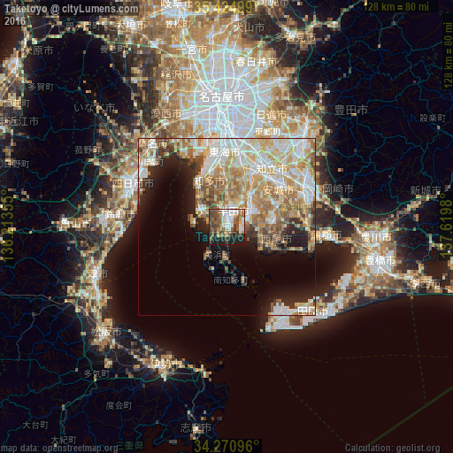
Analysis of Taketoyo night lights 2016
Square area 10x10 km:
100  10.07%
90-99 11.9%
80-89 5.68%
70-79 3.3%
60-69 13.74%
50-59 12.27%
40-49 15.02%
30-39 6.59%
20-29 10.62%
10-19 10.81%
0-9 0%
10.07%90-99
11.9%80-89
5.68%70-79
3.3%60-69
13.74%50-59
12.27%40-49
15.02%30-39
6.59%20-29
10.62%10-19
10.81%0-9
0%Square area 50x50 km:
100 6.97%
90-99 8.35%
80-89 5.95%
70-79 5.55%
60-69 7.44%
50-59 4.6%
40-49 3.5%
30-39 2.95%
20-29 4.98%
10-19 7.66%
0-9 42.06%
6.97%90-99
8.35%80-89
5.95%70-79
5.55%60-69
7.44%50-59
4.6%40-49
3.5%30-39
2.95%20-29
4.98%10-19
7.66%0-9
42.06%Clear (daylight) street map image can be seen on geolist.org.
Map coordinates:
35° 25' 30" North, 136° 12' 48.8" East
34° 51' 0" North, 136° 55' 0" East
34° 16' 15.5" North, 137° 37' 11.3" East
Some cities around Taketoyo sort by population:
• Kariya
16 km =9.9 mi,  22°
22°
• Handa
4 km =2.5 mi, 22°
• Nishio
12.3 km =7.6 mi,  81°
81°
• Hekinan
7.1 km =4.4 mi,  58°
58°
• Tokoname
7.1 km =4.4 mi,  301°
301°
• Takahama
9.6 km =6 mi,  39°
39°
• Ishiki
10.7 km =6.6 mi,  121°
121°
• Toyohama
15.7 km =9.8 mi,  174°
174°
1850818 (p: 41,679)
Sources (retrieved 2019-11-25):
» Earth at Night: Flat Maps 2012, 2016