Kochi night lights from space
Night Light of Kochi from space (Japan) Src. Average luminocity for 10x10km area is 59.3718% and for 50x50km: 6.3912%.
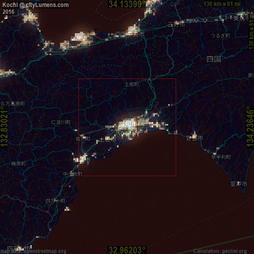
Analysis of Kochi night lights 2016
Square area 10x10 km:
 10.44%
90-99
14.29%80-89
11.36%70-79
7.33%60-69
9.34%50-59
3.11%40-49
8.61%30-39
10.26%20-29
14.1%10-19
11.17%0-9
0%Square area 50x50 km:
0.51%90-99
0.83%80-89
0.92%70-79
0.75%60-69
0.88%50-59
0.98%40-49
1.05%30-39
0.93%20-29
1.98%10-19
4.82%0-9
86.34%Clear (daylight) street map image can be seen on geolist.org.
Map coordinates:
34° 8' 2.4" North, 132° 49' 48.8" East
33° 33' 0" North, 133° 31' 60" East
32° 57' 43.3" North, 134° 14' 11.3" East
Some cities around Kochi sort by population:
• Niihama
50.3 km =31.3 mi,  335°
335°
• Saijō
52.1 km =32.4 mi,  321°
321°
• Kan’onjichō
65.1 km =40.5 mi,  9°
9°
• Kawanoechō
52 km =32.3 mi,  4°
4°
• Susaki
28.3 km =17.6 mi,  232°
232°
• Ino
9.3 km =5.8 mi,  270°
270°
• Aki
34.4 km =21.4 mi,  99°
99°
• Ikedachō
58.9 km =36.6 mi,  25°
25°
1859146 (p: 335,570)
Sources (retrieved 2019-11-25):
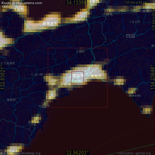
» NASA, Earths city lights 1995
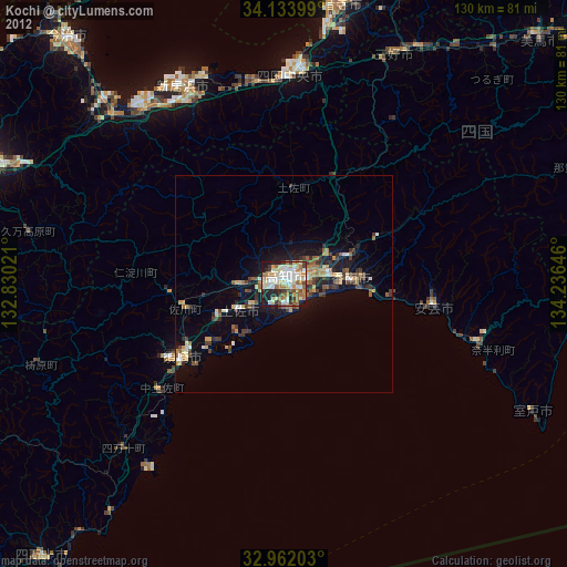
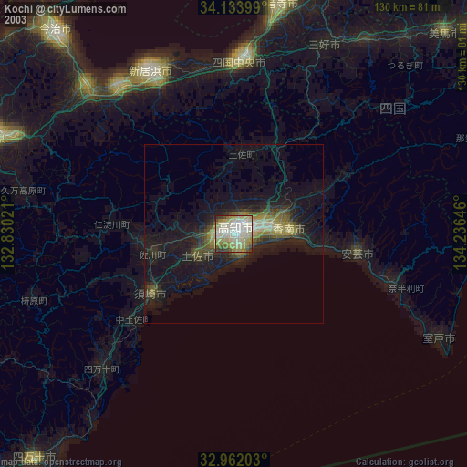
» NASA city lights 2003
» Earth at Night: Flat Maps 2012, 2016