Kadoma night lights from space
Night Light of Kadoma (Ōsaka) from space (Japan) Src. Average luminocity for 10x10km area is 99.8773% and for 50x50km: 69.8279%.
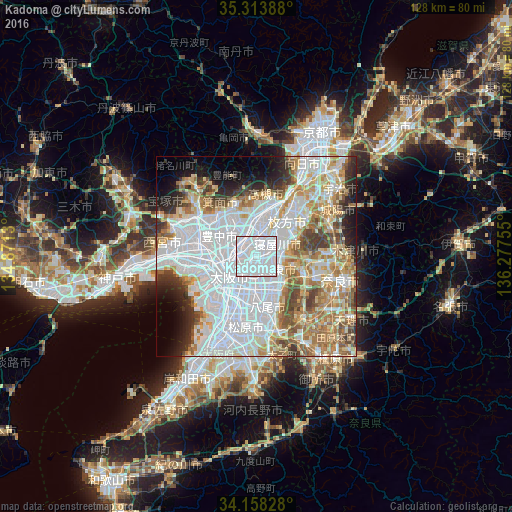
Analysis of Kadoma night lights 2016
Square area 10x10 km:
 90.84%
90-99
9.16%80-89
0%70-79
0%60-69
0%50-59
0%40-49
0%30-39
0%20-29
0%10-19
0%0-9
0%Square area 50x50 km:
30.83%90-99
14.05%80-89
7.39%70-79
6.51%60-69
8.17%50-59
5.93%40-49
4.6%30-39
4.26%20-29
4.83%10-19
5.34%0-9
8.09%Clear (daylight) street map image can be seen on geolist.org.
Map coordinates:
35° 18' 50" North, 134° 52' 16.7" East
34° 44' 17.2" North, 135° 34' 27.9" East
34° 9' 29.8" North, 136° 16' 39.2" East
Some cities around Kadoma sort by population:
• Osaka
8.2 km =5.1 mi,  233°
233°
• Hirakata
10.8 km =6.7 mi,  39°
39°
• Toyonaka
10.8 km =6.7 mi,  297°
297°
• Suita
6 km =3.7 mi, 295°
• Ibaraki
8.7 km =5.4 mi,  356°
356°
• Neyagawa
5.8 km =3.6 mi,  57°
57°
• Moriguchi
0.9 km =0.6 mi, 233°
• Daitōchō
5 km =3.1 mi,  122°
122°
1860871 (p: 131,727)
Sources (retrieved 2019-11-25):
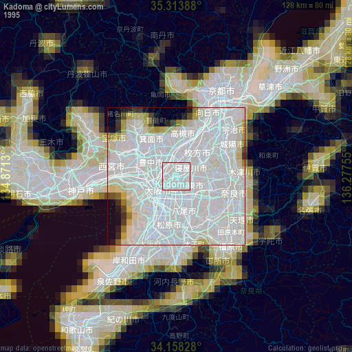
» NASA, Earths city lights 1995
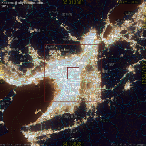
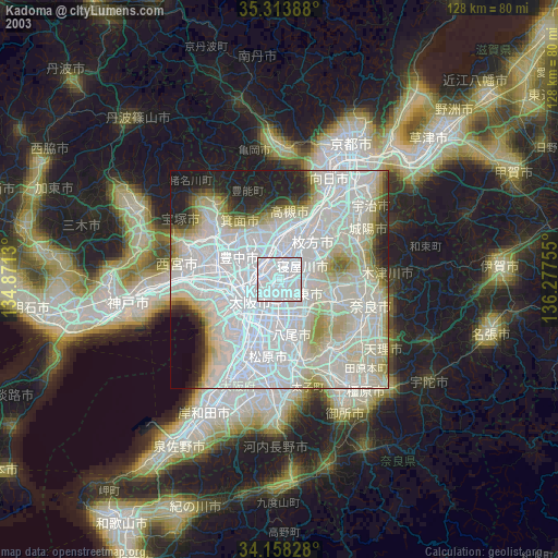
» NASA city lights 2003
» Earth at Night: Flat Maps 2012, 2016