Beppu night lights from space
Night Light of Beppu (Oita) from space (Japan) Src. Average luminocity for 10x10km area is 30.6923% and for 50x50km: 8.5677%.
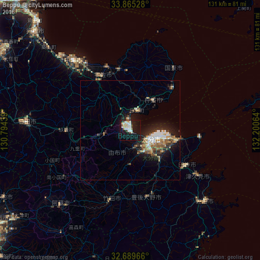
Analysis of Beppu night lights 2016
Square area 10x10 km:
 5.59%
5.59%90-99
8.22%80-89
4.37%70-79
2.45%60-69
0.7%50-59
1.92%40-49
2.8%30-39
1.22%20-29
2.1%10-19
48.08%0-9
22.55%Square area 50x50 km:
1.27%90-99
1.43%80-89
1.1%70-79
0.85%60-69
1%50-59
1.34%40-49
0.9%30-39
1.15%20-29
2.24%10-19
6.99%0-9
81.73%Clear (daylight) street map image can be seen on geolist.org.
Map coordinates:
33° 51' 55" North, 130° 47' 39.8" East
33° 16' 46" North, 131° 29' 51" East
32° 41' 22.8" North, 132° 12' 2.3" East
Some cities around Beppu sort by population:
• Ōita
10.8 km =6.7 mi,  118°
118°
• Tsurusaki
18.4 km =11.4 mi,  101°
101°
• Usuki
33.4 km =20.8 mi, 121°
• Hiji
10.6 km =6.6 mi,  16°
16°
• Bungo-Takada-shi
31.2 km =19.4 mi,  351°
351°
• Kitsuki
19.2 km =11.9 mi,  35°
35°
• Tsukawaki
31.7 km =19.7 mi,  269°
269°
• Takedamachi
35.9 km =22.3 mi,  194°
194°
1864750 (p: 125,065)
Sources (retrieved 2019-11-25):
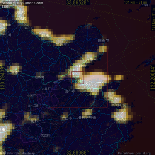
» NASA, Earths city lights 1995
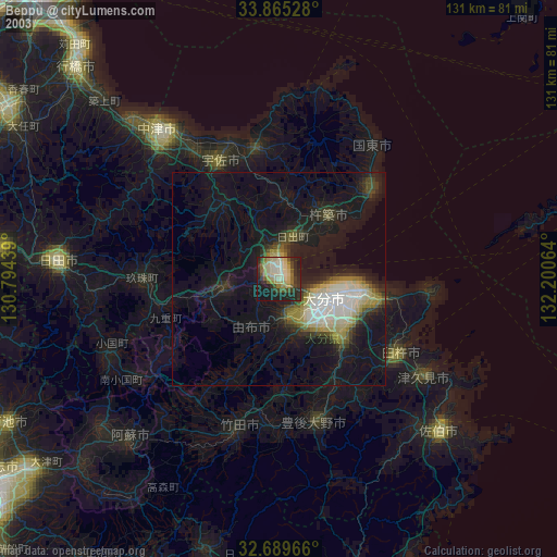
» NASA city lights 2003
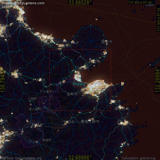
» Earth at Night: Flat Maps 2012, 2016