Rosolini night lights from space
Night Light of Rosolini (Sicily) from space (Italy) Src. Average luminocity for 10x10km area is 23.2744% and for 50x50km: 14.6795%.
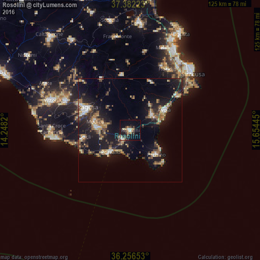
Analysis of Rosolini night lights 2016
Square area 10x10 km:
100  3.57%
3.57%
90-99 2.27%
80-89 2.76%
70-79 2.6%
60-69 3.25%
50-59 1.46%
40-49 4.22%
30-39 4.38%
20-29 4.87%
10-19 23.05%
0-9 47.56%
3.57%90-99
2.27%80-89
2.76%70-79
2.6%60-69
3.25%50-59
1.46%40-49
4.22%30-39
4.38%20-29
4.87%10-19
23.05%0-9
47.56%Square area 50x50 km:
100 1.31%
90-99 1.35%
80-89 1.97%
70-79 1.76%
60-69 2.34%
50-59 1.85%
40-49 2.14%
30-39 3.12%
20-29 3.95%
10-19 16.26%
0-9 63.96%
1.31%90-99
1.35%80-89
1.97%70-79
1.76%60-69
2.34%50-59
1.85%40-49
2.14%30-39
3.12%20-29
3.95%10-19
16.26%0-9
63.96%Clear (daylight) street map image can be seen on geolist.org.
Map coordinates:
37° 22' 56" North, 14° 14' 53.5" East
36° 49' 17.2" North, 14° 57' 4.8" East
36° 15' 23.5" North, 15° 39' 16" East
Some cities around Rosolini sort by population:
• Ragusa
23.3 km =14.5 mi,  299°
299°
• Modica
17.6 km =10.9 mi,  283°
283°
• Avola
19.3 km =12 mi,  59°
59°
• Pachino
17.1 km =10.6 mi,  133°
133°
• Noto
13.2 km =8.2 mi,  53°
53°
• Pozzallo
13.8 km =8.6 mi,  222°
222°
• Scicli
22.4 km =13.9 mi,  261°
261°
• Ispica
5.7 km =3.5 mi,  226°
226°
2523581 (p: 19,721)
Sources (retrieved 2019-11-25):
» Earth at Night: Flat Maps 2012, 2016