Romentino night lights from space
Night Light of Romentino (Piedmont) from space (Italy) Src. Average luminocity for 10x10km area is 45.1714% and for 50x50km: 39.4973%.
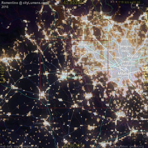
Analysis of Romentino night lights 2016
Square area 10x10 km:
 5.56%
5.56%90-99
7.78%80-89
6.67%70-79
7.3%60-69
4.13%50-59
3.17%40-49
5.24%30-39
6.98%20-29
47.3%10-19
5.87%0-9
0%Square area 50x50 km:
8.24%90-99
9.53%80-89
3.53%70-79
4.59%60-69
5.32%50-59
4.28%40-49
4.26%30-39
4.43%20-29
10.17%10-19
19.4%0-9
26.25%Clear (daylight) street map image can be seen on geolist.org.
Map coordinates:
45° 57' 14.2" North, 8° 0' 54" East
45° 27' 46.7" North, 8° 43' 5.2" East
44° 58' 3.5" North, 9° 25' 16.5" East
Some cities around Romentino sort by population:
• Novara
7.8 km =4.8 mi,  256°
256°
• Trecate
3.5 km =2.2 mi,  156°
156°
• Galliate
2.4 km =1.5 mi,  319°
319°
• Castano Primo
10.8 km =6.7 mi,  24°
24°
• Cameri
6.1 km =3.8 mi,  314°
314°
• Cuggiono
9 km =5.6 mi,  57°
57°
• Turbigo
7.7 km =4.8 mi,  10°
10°
• Cerano
7.9 km =4.9 mi,  139°
139°
3169035 (p: 5,234)
Sources (retrieved 2019-11-25):
» Earth at Night: Flat Maps 2012, 2016